It’s a pretty extreme day for Arctic Amplification (AA). I thought I had better preserve this set of images from the weather maps, and there is no better place to do so than right here. I’ll keep it as short as possible, but no fewer than seven different images are needed to best obtain the full story. We’ll start with today’s temperature anomaly. The numbers at the bottom summarize the meaning of AA for only one day, but every day counts when the time comes to add them all up to see what the overall picture of AA has been for any month, or any full year:
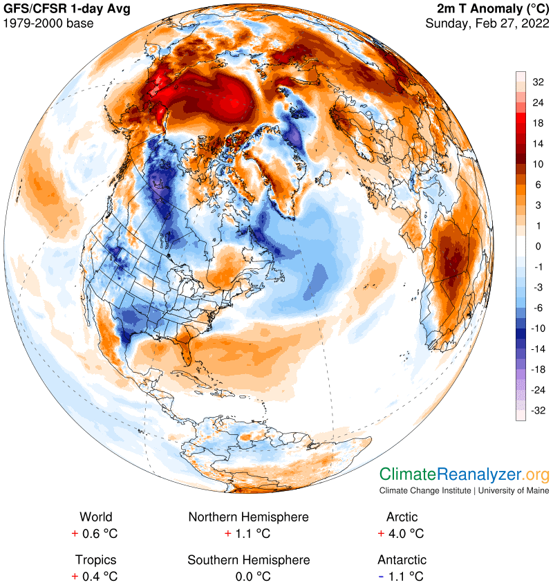
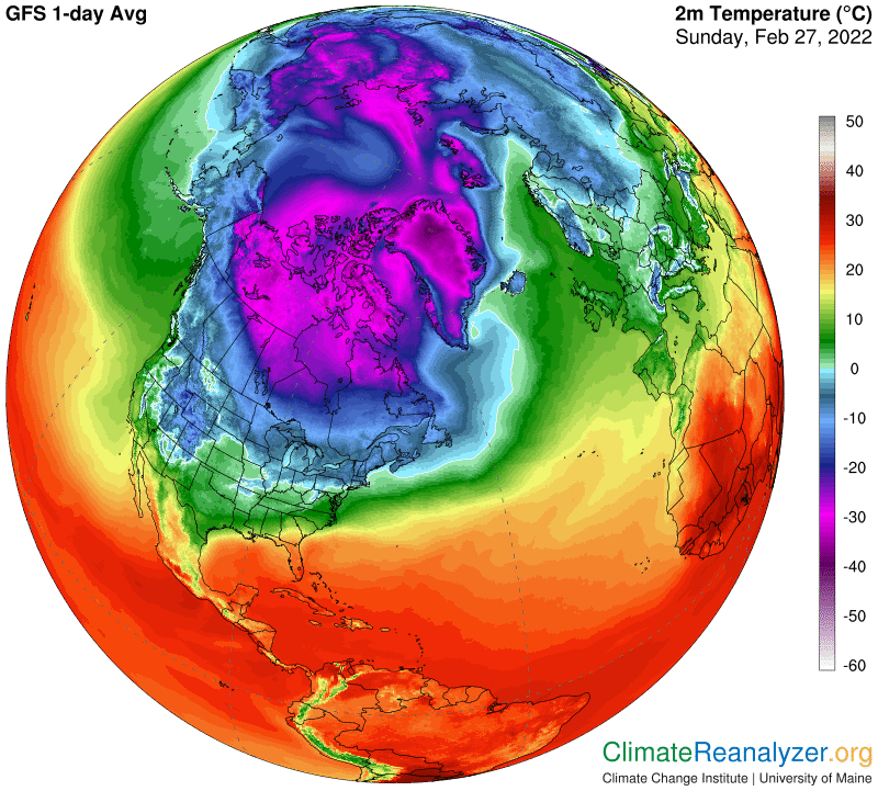
The big patch that stands out covers most of the ocean. The warmest anomaly of all is on the far eastern tip of Siberia, at a bit more than 21C. Here are the actual temperature averages:
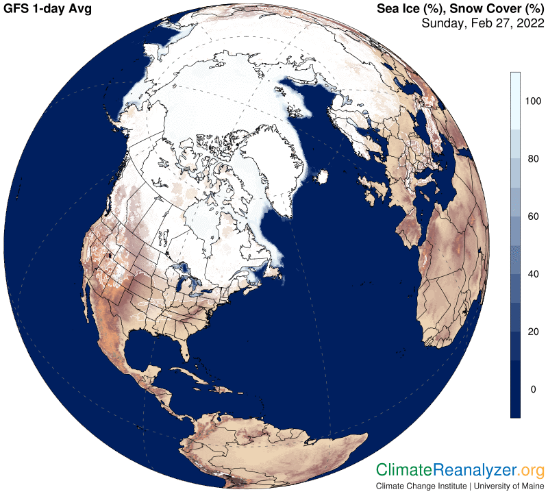
Something has to be causing this huge anomaly on this particular day, and it cannot possibly have anything to do with sea ice, which I am confident is about the same every day at this time of year:
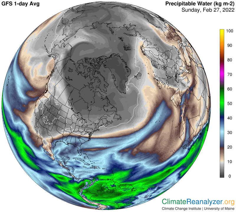
Precipitable water (PW), carried in by atmospheric rivers (ARs), is an entirely different story. Entry points in the Bering Strait area are well-defined, followed by the area of content spreading in ever-diminishing quantities. (Use magnification of at least 300% to make out all the details.) Some of the PW content derived from these ARs is being transported all the way to the North Pole:
How is the transport managed? I can see that jetstream winds have a major role, beginning with the collection of moisture that evaporated in central parts of the Pacific. These jets and their passengers are seen sweeping deeply into the heart of the polar zone before dumping off the last of the passengers and turning back:
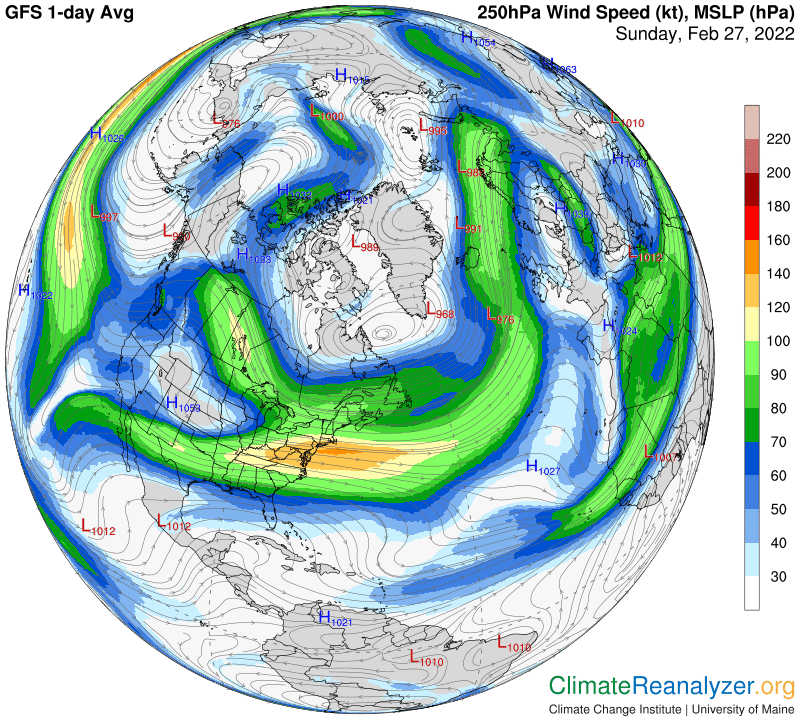
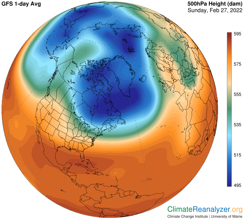
I find it interesting to observe the extraordinary way the high-altitude configuration of air pressure gradients was set up today, thereby managing the course of travel taken by the jets:
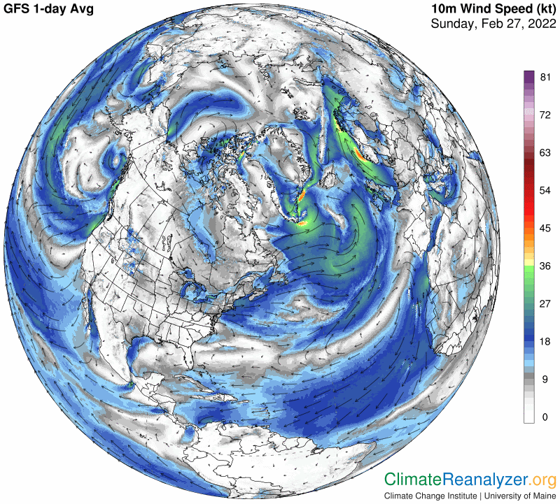
Lower level winds, on tracks governed by sea level air pressure, must also have had a strong hand in the distribution of this PW. (Could the lower level winds actually have held the upper hand? I’m not sure.)
Carl