Today’s Weather Maps seldom produces an error in its displays, but today it did, and this is one that we can use to our advantage as a study of relationships. One of the maps of Jetstream Wind Speeds failed to give us the speed imagery but does contain lots of isobar information, displayed over a wide area without the usual obfuscation of details. Here is how it turned out:
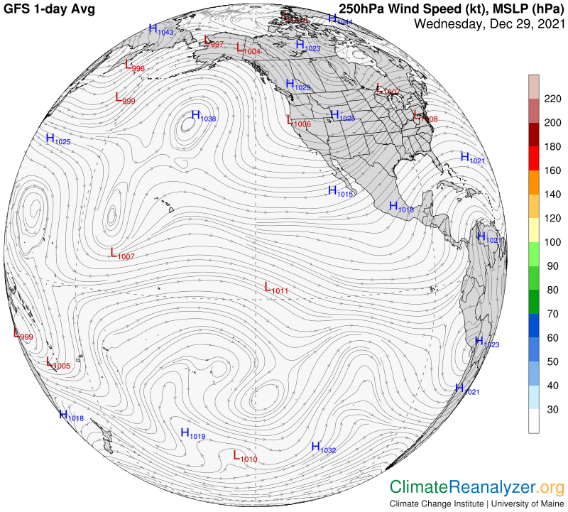
This error gives us a great opportunity to see exactly how these isobars match up with the color coding on another map, the one called “500hPa Geopot. Height,” which I generally prefer to designate as a map of “high-altitude air pressure configuration.” The color coding on this map intends to provide us with a useful breakdown of the way the air pressure isobars are located, but succeeds in doing so in only a highly rudimentary way, as this next image makes obvious:
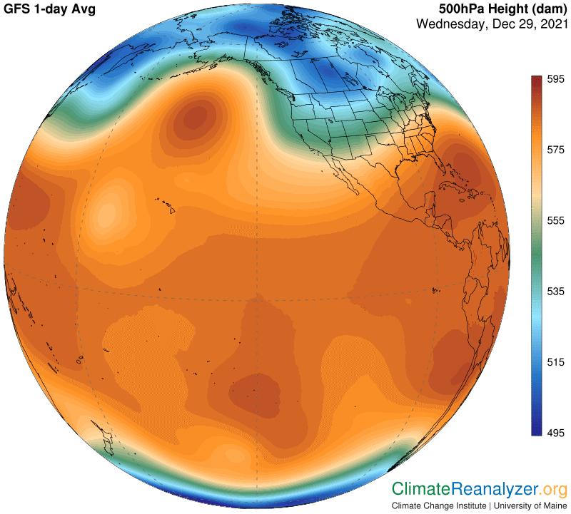
If you set up these two maps side by side, and toggle back and forth between them, you can picture a way to fill in all of the isobar details left out by the color coding. Bear in mind that the above isobar details are all being transferred from a Jetstream map—so how does that figure? As I’ve said in countless past letters, it’s because these isobars determine the location of each of the pathways that govern the day-by-day positioning of the four separate species of major jetstream winds that we normally want views of. These winds all have intermittent irregularities of speed and are variable in properties of curvature and width. They interact with each other whenever pathways become close, and sometimes split into two parts that don’t always reconnect, but none of the winds are allowed to wander away from naturally designated pathways, as defined by specific air pressure differentials. The connection is absolute. Most of the time each of these four major pathways will endlessly circle the entire globe, but pieces do break off and rejoin ends, forming tighter and more localized circles that are soon likely to disintegrate.
I wish I had a regular map of jetstream winds for today that could be added to the other two, and maybe the producers will yet enact a repair, but have no expectation. It would show how well the actual streams stick to their pathways. We could obtain the best possible view of how the four majors differ in pathway location, one on the border of the configuration zone shaded in blue, one on the border of the zone shaded in green, and the other two in interior parts of the red zone, where different shadings are less easily identified. (Scroll down to CL#2094 for more on this.)
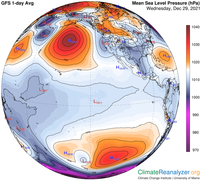
In the above two maps, note that the air pressure differentials are measured at 500hPa, which is just over three miles high, and the jetstream winds at 250hPa, seven miles up. The different parts all fit together almost perfectly. The high altitude configuration is fully established at a level not far below the 500hPa threshold. Once established there is no likelihood of further change all the way to the top of the troposphere. The next image shows today’s configuration of ordinary air pressure isobars that exist near the surface, before undergoing the regular conversion into the mode that prevails higher up. Surface winds are governed by the same principles as those in the upper mode, but end up with completely different speeds, positioning and spatial distribution features. The two wind systems, upper and lower, operate independently while largely confined to the middle and higher latitudes of each hemisphere. In contrast the tropical zone maintains much less difference in the patterns of air pressure and wind performance because of changes in altitude. Jet streams may appear, but only occasionally.
Carl