There are four major streams of water vapor now emerging from warm subtropical waters in the Northern Hemisphere and rising high enough to enter the upper level wind system, which is the home of jetstream winds. They can all be seen clearly on this first map. One stream rises from the western Pacific, one from the central Pacific, one from the Caribbean part of the Atlantic and the fourth from surfaces to the west of North Africa. These stream sources all have some degree of permanence but they are also subject to considerable change from any one day to the next. I think the one emerging from the central Pacific, which was described in my letter two days ago, is the most interesting because of its large size and diversity of effects, especially with respect to its enforcement of Arctic Ocean air temperatures. This stream has recently changed in ways that make it an even stronger contributor.
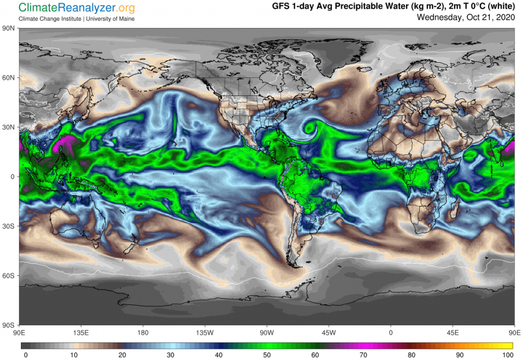
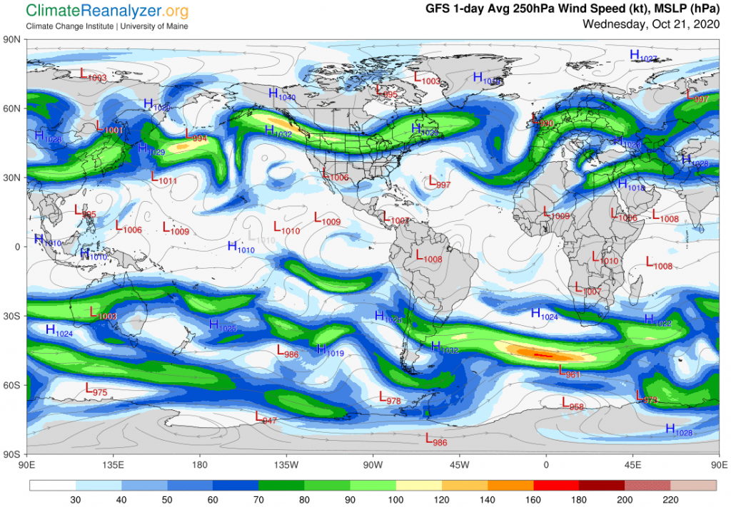
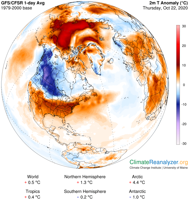
The base of the stream, marked by an atmospheric total of 40kg of water content per square meter, is now running freely to the north and east until it smashes head-on into the side of a strong jetstream wind, as depicted on a lower chart. The original concentration simply disintegrates at that point, and its vapor content is spewed out to either side, along with some that is incorporated into the eastward moving jet. The vapor thrown out to the west finds a gap in the strength of the jet wind, passes through and reorients toward a northward course, where it soon finds a direct passage over the Arctic Ocean. At this point it is marked by 10kg of water content, only a small part of which is contributed by vapors of the lower atmosphere at this latitude. The differential is great enough to create a temperature anomaly of perhaps 12C, which expands to a reading of about 15C when the very warm surface water anomaly is included. (See yesterday’s letter for an explanation of why these figures must be separated.) It does not look like the western Pacific vapor stream is now contributing anything substantial to the total.
The vapor from this major stream that headed to the east after the breakup has had interesting effects of its own. The portion absorbed by the strong jetstream wind has been massive enough to account for widespread snowfall in the center of the continent, where some records have been broken. I believe the vapor that avoided being trapped in the jet was routed toward California without being condensed and has contributed to the heating of that state. The major cold anomaly crossing the continent is mainly due to the work of the strong jet, which has not allowed any normal amount of streaming vapor to cut across its path and spread normal quantities of greenhouse energy over the lands on the north side of the jet. Today’s jetstream map:
Going back to the two major vapor streams emerging from the Atlantic in the first map, both of these are contributing to Arctic warming from the other side of the world, as reported yesterday. The effect is not nearly as dramatic as the warming on the Pacific side, but if you look closely at this next image you will see an anomaly hot spot of about 15C north of Greenland that could not have been enhanced by surface water. Their influence in this field has potential to expand. The stream coming from the Caribbean region is also responsible for the intense warming in the southeastern part of the US. The other Atlantic stream is doing the same for Europe, using the relatively mild jetstream wind that is shown moving northward as a principal conveyor.
There is a story today in The Guardian about the retarded rate of ice formation on the Arctic Ocean this fall, including explanations for the surface water anomalies. The scientists who were quoted had little to say about the major air temperature anomaly that is now almost a month old. https://www.theguardian.com/world/2020/oct/22/alarm-as-arctic-sea-ice-not-yet-freezing-at-latest-date-on-record
Carl