There is something new to look for now in the Weather Maps. Every day I make a quick check of sea surface temperature anomalies on the maps, paying special attention to average increases in the Northern Hemisphere, which lately have been running a little higher than the combined NH land/sea increases. That’s a strange thing in itself, and I will not even try to give it an explanation. Today I took notice of something else that is strange, out in the north-center of the North Pacific Ocean—a spot of surface water anomaly close to 5C in the middle of a large warm patch that averages nearly +4C. It’s a reminder of the ‘blob” event that occurred nearby in the years 2014-16, plus a recurrence of just one year ago, with annual peaks being in September. Here is today’s picture:
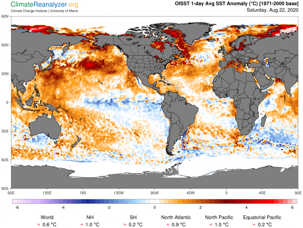
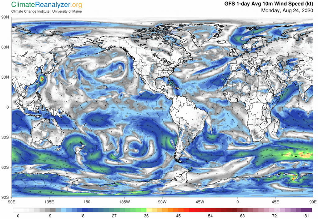
What’s going on? And why so many other large warm patches out in the wide open waters of the North Pacific where there is no shelter? Shouldn’t high winds and regular currents take care of things like that? A quick check of what the winds are like today might be revealing. What we are actually getting is a surprising amount of almost dead calm in places, probably in a pattern that has not changed much for quite some time in order for such large anomalies to have had enough time to build up:
Does this situation have any implications for climate change in general, either now or in the future? That basically depends on the possibility that this is a type of phenomenon destined to become yet more common in summers to come. It certainly did not happen with any degree of regularity late in the last century, or we would not be seeing these large anomalies. If it is going to happen repeatedly there is one particular effect I can see that is of special interest because of its potential for impacting air temperatures not just over the oceans but upon continental land areas. It is happening now, via a process you are familiar with if you have been reading these letters. The process involves the creation of a substantial addition to the total amount of global water vapor that has the ability to rise several miles up and gain entry to the upper-level wind system where jetstream winds are in play. From this Pacific location the vapor streams that arise would be in position to sweep over both the polar region and much of western North America, and are indeed doing so. This next image will demonstrate how a principal initial requirement is being met:
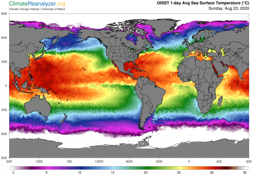
Give your attention to the surface area of the ocean that is located within the same area as the large anomaly featured above. Because of the added heat a good share of that particular area is now showing water temperatures of 25-27C, which is enough to provide all the energy needed to boost vapor streams to the specified altitude after evaporation. Moreover there is an abundance of clear sky in the region—which can best be viewed on the Windy website—facilitating a smooth transfer. Do we know this is happening now? The best way to find out is by opening of the Precipitable Water map, where this is the picture today:
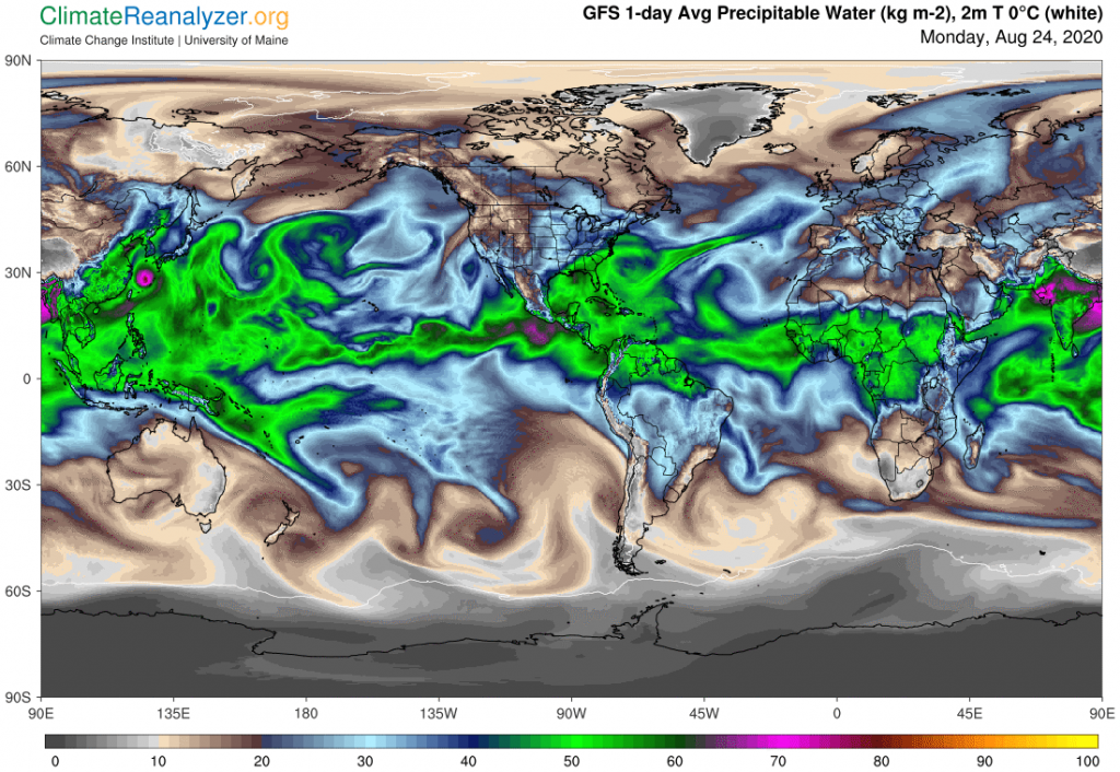
What I see is immense quantities of vapor in that area having weights of 40kg per square meter, or even more, that are headed on paths leading to both the NA West Coast and Alaska and beyond. If you are able to open the animated version of precipitable water soon enough you will see the complete movement happening with great clarity. This sort of thing could go on every day during the late summer months of any year before pulling back for the winter. Temperature effects, while constantly changing, will be felt over long distances, perhaps adding to the figures of climate change.
Carl