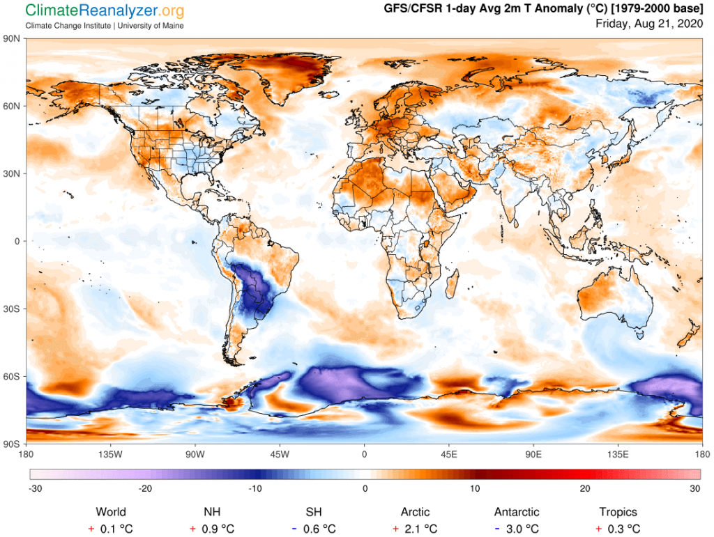
We’re going back to that South American cold anomaly today. It has a number of unique features that make it not just extra interesting but also extra difficult to properly explain. Cold anomalies of this size and intensity are very rare occurrences outside of the polar regions. Half of this one is in the tropics, and the tropical part has actually expanded a bit to the north since yesterday. The top image has a snapshot of all global anomalies for the day so you can see how it stands out. Also take note of how the Northern Hemisphere is loaded with warm anomalies and only a few cool ones. And don’t overlook the stats at the bottom, showing how the SH as a whole is considerably cooler today than it was three decades ago, nearly wiping out any net gain for the globe during this very limited period. It has been trending that way for several weeks now. The NH at +0.9C is quite the opposite, still going very strong.
One strange thing about the anomaly is the way it is composed, which I did not pay enough attention to yesterday. It has a top part and a bottom part of almost equal size. The top part is made up of a heavy band of clouds, most of which are at medium altitude and rain-bearing. These clouds are part of a long trail that crosses the continent and then extends far into the South Atlantic, trending right along the upper edge of the strong jetstream that we viewed yesterday and which is about the same today. Here is the image of the long cloud stream and its rain content:
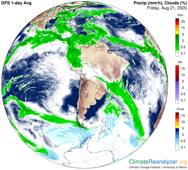
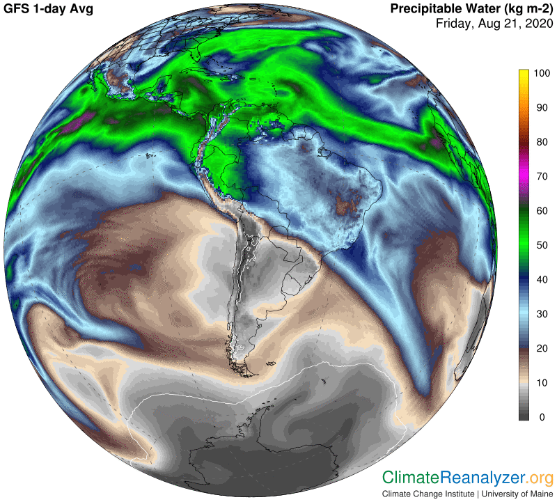
In the next map there is an image that shows how massive is the amount of Precipitable Water that exists in the Amazon basin. From the above map we can tell that the bulk of it must just be vapor, simply because so much of the region is currently unclouded. The thick clouds that we do see have basically formed only in proximity to the strong jet wind, creating what amounts to a parallel stream of its own, which surely must be telling us something more of interest. The cloud stream is obviously thick with water molecules, a thickness that suggests they have been collected from the entire area of the basin that lies immediately to the north. This must be be a continuous process, just as evaporation is continuous. Upon collecting the cloud of condensed molecules has clearly been compacted into a specific shape that continues to move to the east and south as a well-defined stream. The entire procedure of collecting and compacting suggests that the molecules are all endeavoring to move in a perhaps more decidedly southerly direction but their movement is being held in check by the power of the jetstream.
When clouds become concentrated in this way they inevitably block a large share of incoming solar radiation from reaching the surface, thus leading to cooling of the air. In this particular situation there may be an unusually high degree of blocking, enough to create anomalous cooling at the high level we are seeing in the top half of the anomaly under review. Then what about the lower half, where we see that the sky is perfectly clear? Why is the surface air being cooled by an anomaly of almost exactly the same high amount? I now understand that the lower air is cooling through its own completely different means, and that the similarity between each of the paired anomalies is purely a coincidence. Here it is “too little” water vapor in place on the blocked-out side of the jetstream wind, just the opposite of what we see on the other side, as today’s image shows again. The total package of containment affecting the dry area is not very well-defined on three of the four sides, but vapor entry is somehow being excluded.
There is no visible impact of this massive cold air anomaly on the configuration of high-altitude air pressure today, which I had earlier expected. One possible reason for this may be due to so much of the anomaly being caused by heavy cloud cover, which could lead to a damping down of the usual contraction effect of air that cools. Such clouds are said to be heavy in real weight as well as opacity. Just a thought.
Carl