How to have warm temperature anomalies without any extra water vapor added to the atmosphere. It happens all the time, and the explanation is simple—just clear away the clouds so more sunlight can reach the surface. That alone will add to surface air temperatures, and if it goes on for an extended number of days the surface itself, whether it be land or sea, will be storing a little extra heat each day which will add to its outgoing flux of radiation at night and on each following day as long as the trend continues. That will soon add up to a noticeable and growing source of anomaly when comparing to what normally happened in the past on those same days.
The degree of anomaly capable of being reached in this manner in long-lasting situations would make an interesting subject of study in its own right, if all the proper records could be kept. I think there is nothing unusual about getting anomalies of 3-5 degrees by this process. Going beyond that, up to ten degrees for example, with no immediate assistance from some other source of heat would be highly unusual. Water vapor definitely has the inherent capability to quickly provide a large amount of such heat through the greenhouse effect, and it is hard to think of any other alternative. Whenever you see warm anomalies of 15-20 degrees you can safely bet that water vapor is streaming in from high altitudes overhead and making the difference. Yesterday’s letter provided a current example of the same relationship but on a smaller scale, in a normally very hot region where anomalies as high as 10C are relatively rare.
Meteorologists often use the term ‘heat dome’ when explaining warm temperature anomalies. A heat dome is established when relatively high surface air pressure stays in place over a region for an extended period of time. The elevated air pressure on its own accord is able to inhibit cloud formation, for reasons I cannot clearly explain, but the occurrence is ostensibly true as well as commonplace. Now I want to show some images from today’s weather maps that illustrates what can happen under an ordinary heat dome when water vapor is held at bay. In this first one, observe the warm anomaly along the entire west coast of North America:
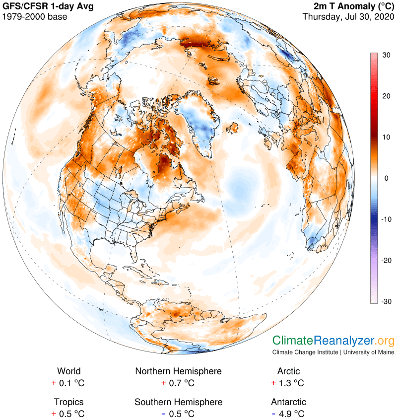
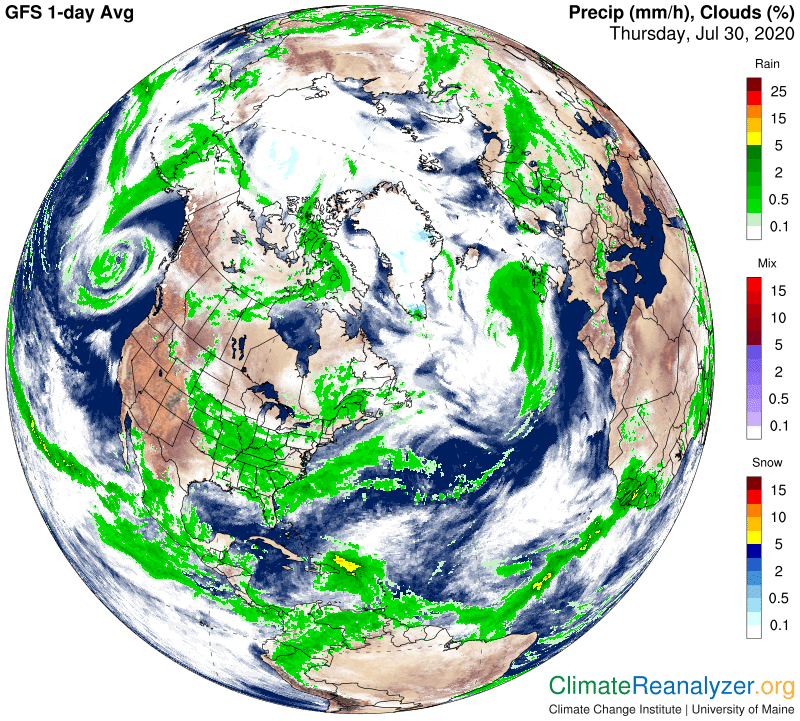
Next, a view showing the complete absence of cloud cover over the area of the anomaly. I am not sure of how long it has been that way, but it was clearly long enough for a close correspondence to develop, probably several days. (On the far right edge see how the clear skies surrounding the Mediterranean region we looked at yesterday are still there, still keeping things extra warm in the same way.)
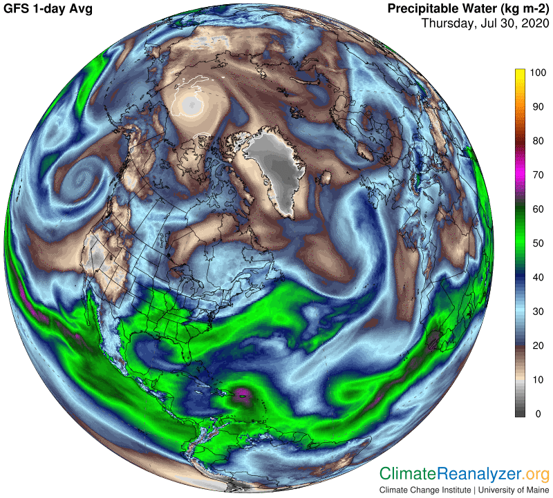
Now let’s see if precipitable water had something to do with this anomaly. This next map is interesting because it shows that two big streams of water vapor moving toward the continent from the Pacific Ocean are both being pushed away from the coast, for unclear reasons, giving pure sunshine an exclusive opportunity to show its power when clouds are missing.
Carl