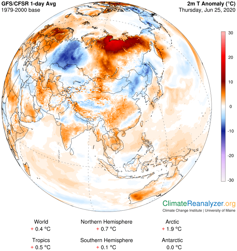
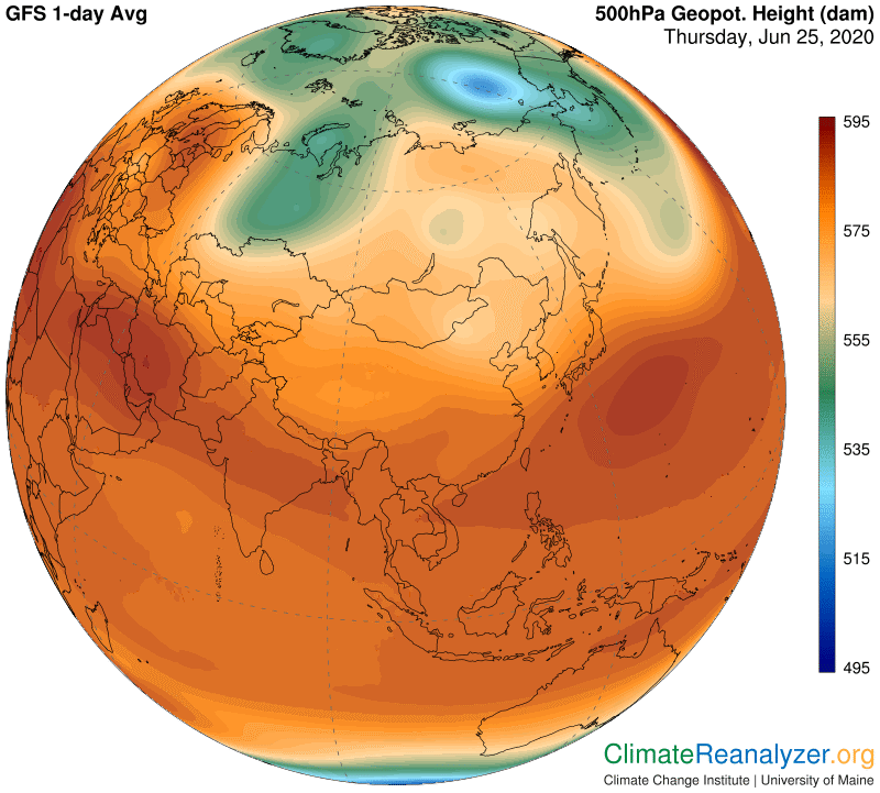
The biggest and strongest warm anomaly in the world right now is the one in northwest Siberia, as shown on the following map. It leaves a strong fingerprint on the 500hPa Geopot map, which helps to keep it going by positioning jetstream winds on routes where they are left unable to block incoming streams of overhead water vapor. The map also shows two substantial cool anomalies, one of which was featured in yesterday’s letter. That one also has a strong Geopot fingerprint that helps to sustain its coolness, but in the exact opposite way, by holding back the high vapor streams. It has in fact gained several signs of strength just since yesterday. The cool anomaly to the east is not quite strong enough to gain a feedback from that kind of help.
Here for reference is the Geopot map, which on close examination actually does show very faint signs of fingerprint-making by the lesser cool anomaly but not enough to do it any good:
The two cool anomalies have one particular thing of real importance in common, which can only be determined by visiting the Windy website. Both of them are dominated by heavy coverage of low-level clouds. I have become convinced that this may be the one outstanding requirement for establishing a cool anomaly as high as 10C over ordinary land surfaces, not applicable to icy extremes and rarely attainable over ocean water. There is another cooling of this type today in northwest Canada, plus the usual string of cold extremes around Antarctica. On the other hand, the above Siberian warm anomaly, with its maximum strength even greater than 10C in some places, is noteworthy for having almost no low cloud coverage at all and even a completely clear sky in many places. The abundance of overhead water vapor can thus provide greenhouse power of undiminished strength.
It is a matter of real interest that the eastern cool anomaly also represents a region that is collecting an abundance of overhead water vapor about equal to the occurrence in the Siberian warm region. So why is there such a huge difference in temperature outcome? Cold rains are observed that may be part of the answer. Otherwise it is hard to draw any conclusion apart from the thought that low level clouds might have additional powers on air temperature beyond ordinary albedo, once the blocking out of sunlight has continued for several days in a row. The surface soils should then cool down enough to sharply reduce the outbound flux of radiation that is always needed for any warming of the air in the first place. Consider, for illustration, how ordinary topsoils and other surface materials everywhere gain and lose around 10-11C on average every 24 hours, day in and day out, and how continuing net losses could be compounded over time. (Or the reverse in warming situations.)
Carl