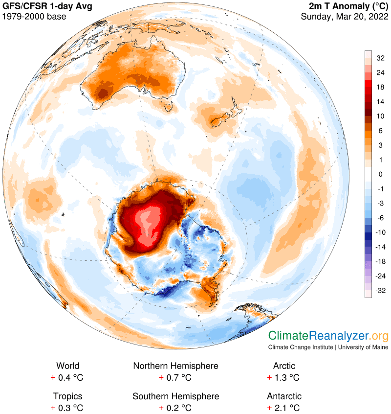
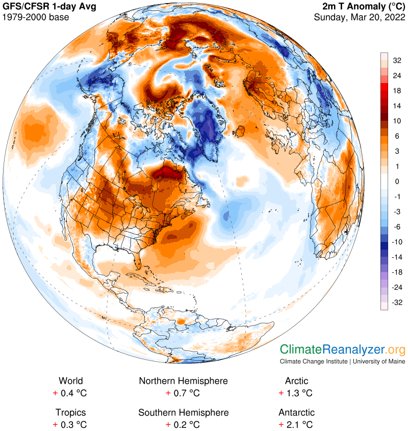
Warm anomalies in both polar regions have dropped a degree or more today. Each change is associated with the reduced influx of a key atmospheric river (AR) and its overhead precipitable water (PW) content. I will be showing four images from each region with limited commentary. I have no plans to continue following Antarctica on a regular basis after this incredible episode, partly for lack of time and also because of several difficulties that I have no way to deal with, which will be explained in a moment. First, today’s anomaly, still large in size but now having no readings over +32 that go off the scale:
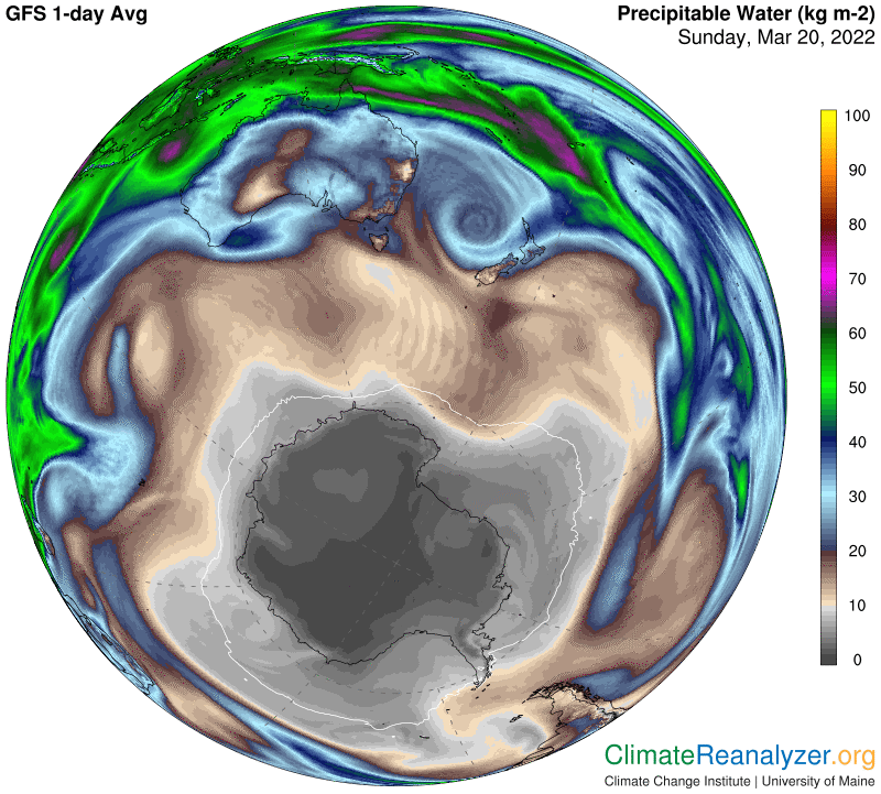
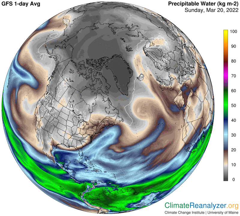
On the PW map I especially want to point out a confusing complication that is difficult to explain. On the above map you can observe a large cool anomaly—about the same size as the warm one and just off to its right. On the PW map you will see that there is not much difference in the pattern of absolute kg values over areas of land in each of these diverse anomalies. How can this be? I believe an explanation could be made by showing stark differences in elevation, but have no means of illustrating either the elevation comparisons or differences in the actual amount of ambient water vapor that is multiplied when an overhead AR arrives:
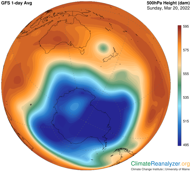
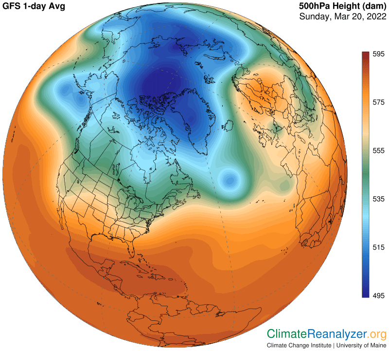
The looping jet stream over the continent has clearly lost strength since yesterday, reducing its ability to transport as much PW as it did before:
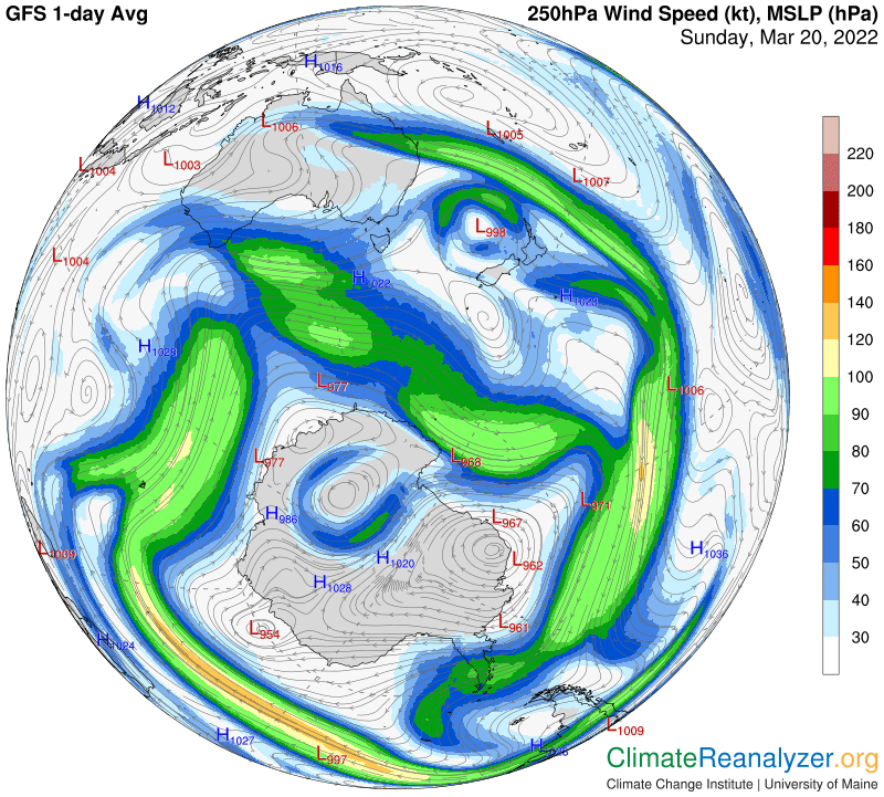
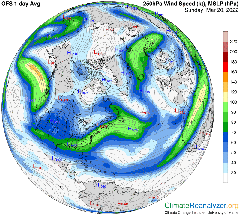
On the air pressure map a bright blue spot is all that remains of the large cavity that formed earlier in the week. The jet stream must be finding a pathway that enables it to stay in place and circle around this spot. I think the spot probably exists—temporarily—as a positive feedback from relatively warm air temperature at the surface below, but must leave that as a speculation:
Now for the Arctic anomaly map, which is in a cooling trend made up of mostly small changes:
The one AR that is supplying most of the PW entering the sky over this region has lost some of its strength, as measured in kg value, at the point of entry and is also following a less direct course of approach:
A growing bulge in the upper right part of the blue zone on this day has expanded the zone toward the east:
As a result we can see a distinct bend in the pathway taken by the strong jet that is involved here each day. This would be a good reason behind the change of course taken by the principal AR we are watching, causing it to diffuse its contents and lose intensity when it stops. (You may want to directly compare these images with the ones in yesterday’s letter in order to get the clearest picture.)
Carl