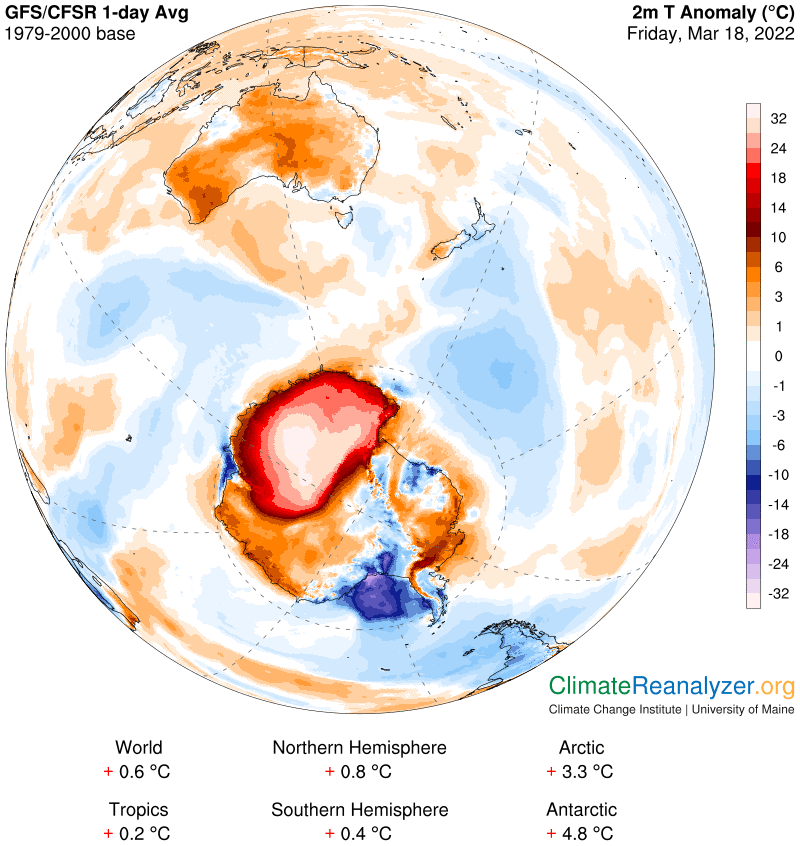
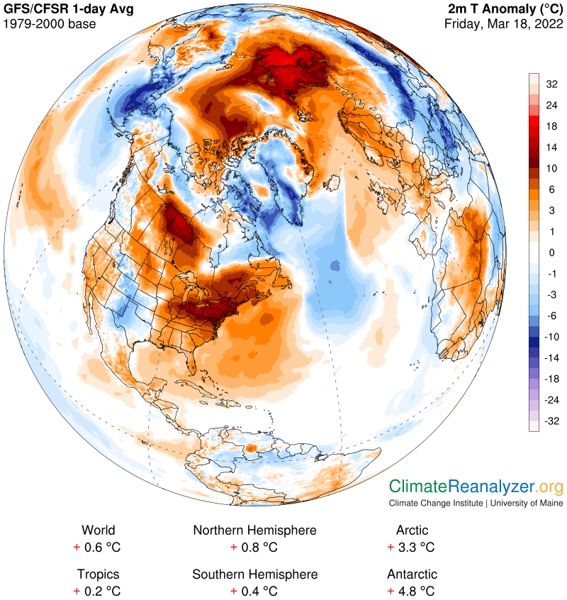
Antarctica captured my attention again today with an anomaly of +4.8C. The average for the whole continent is now up a total of 5.6 degrees in just four days. The bulk of the gain is happening in just one quarter of the entire zone, and in particular on a fairly large area (whitish patch) which has an astounding reading greater than 32C—which is no less than +58F.and maybe 60 or more:
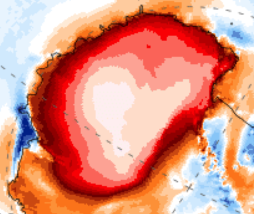
Here is how it looks when magnified by 400%. This makes it easier to distinguish the obscure difference between two shades of deep red on the map when you get your face up close to the screen:
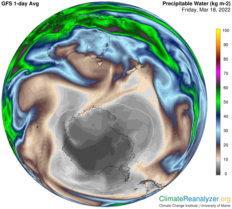
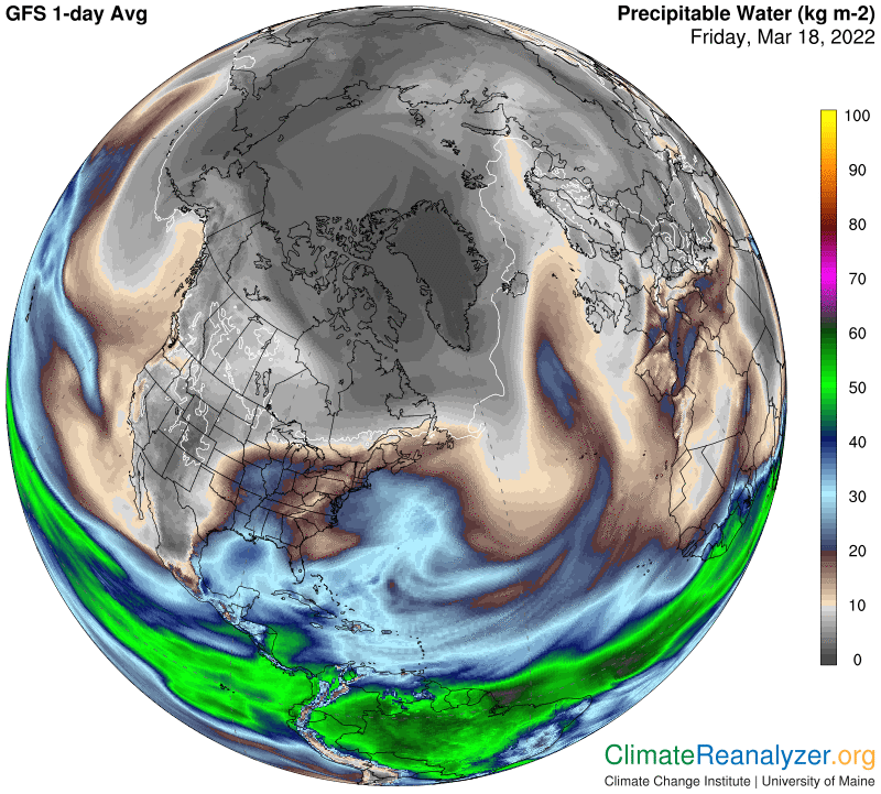
Like yesterday, a relatively massive influx of precipitable water (PW), formed as the body of an incoming atmospheric river (AR) in the overhead atmosphere, created overwhelming multiples of ambient quantities of ground level PW. On a normal day Antarctica is notorious for its regular ability to resist any AR penetration of this type. Today is a truly major exception:
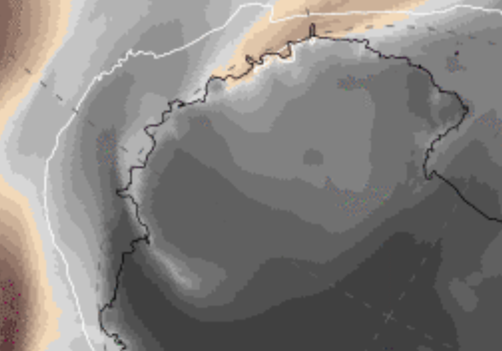
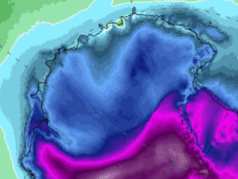
How the region looks when PW differences are well-magnified. Inside the zone of darkest gray shading you can get actual kg values well below 500 grams, but there is no way to read them on these maps:
I also want to give you a magnified view of actual temperatures in this same area today. The area of coldest anomaly has readings that mostly range between -10 and -20C. Magenta is -30, and below that you’ll find readings near the pole that drop below -50C and are fairly close to normal. In all of these places “normal” depends on how high the mountains are in each locality. The highest are away from the pole.
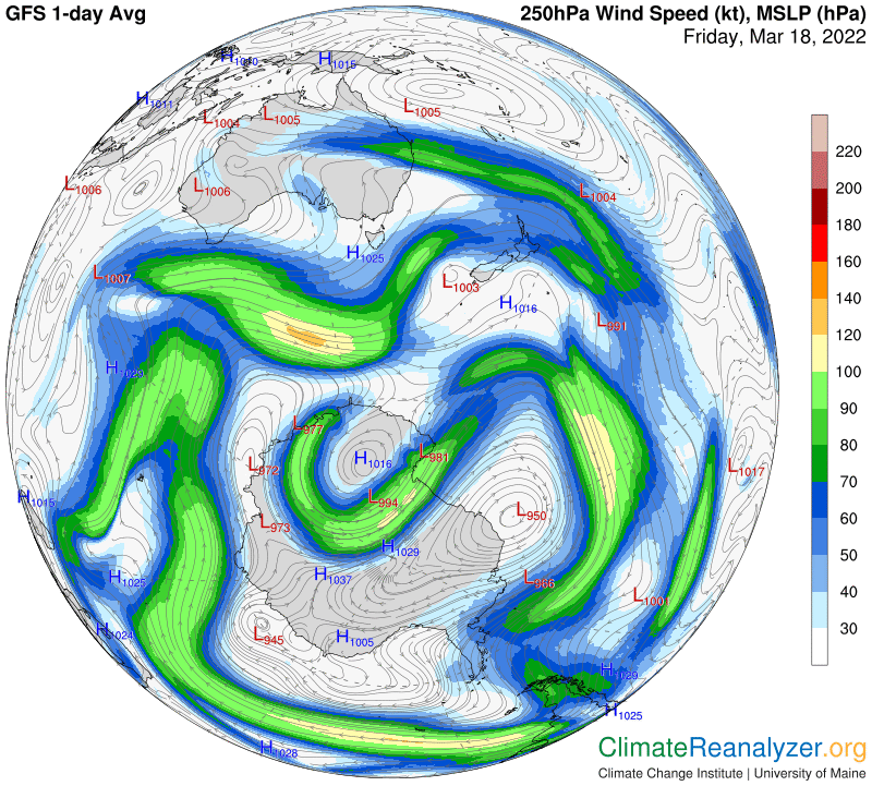
The following two maps are similar to those shown in yesterday’s letter, with the principal features appearing a bit larger and equally intensified:
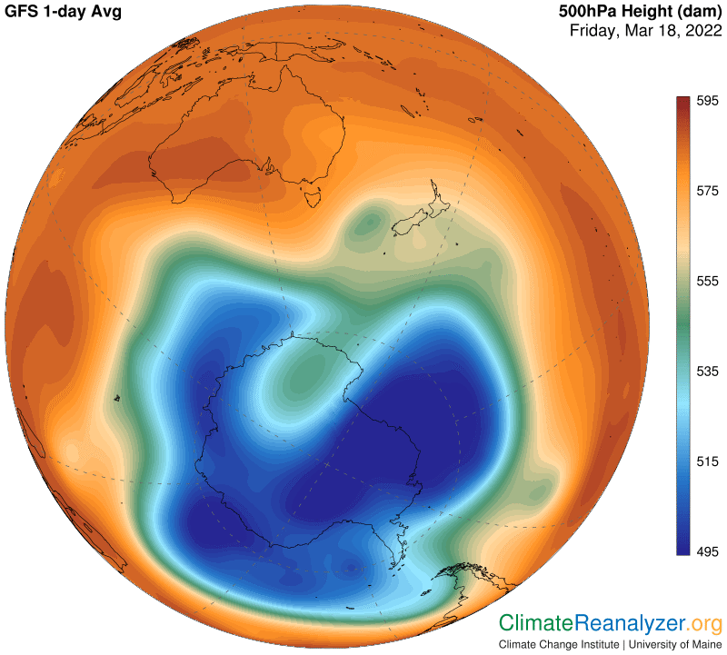
Now we can proceed with our regular overview of daily changes in the Arctic warming pattern. The warm anomaly area is again very broad, and still very high at +3.3C, but not nearly as intense as the one we’ve been studying above. Observe how about 80% of the broad warm anomaly is surrounded by an unbroken string of cool anomalies. The energy doing the warming of the interior is all being introduced through a window that stretches from Greenland across Scandinavia into northern Russia:
This energy supply is being fed by a massive AR that originated in the central Atlantic. Unlike the river we just saw in Antarctica, which was carried in by a strong jet stream that made a wide circular loop and then pulled out, this AR simply came to a stop, spilling out most of its contents in the act of stopping. These contents have then become dispersed, along with considerable freedom to roam for long distances over a broad landscape:
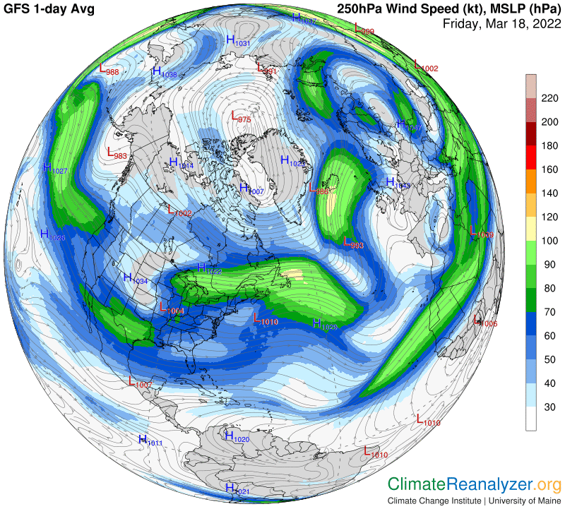
There is a present and quite normal dearth of significant jetstream wind activity in the center of the Arctic region:
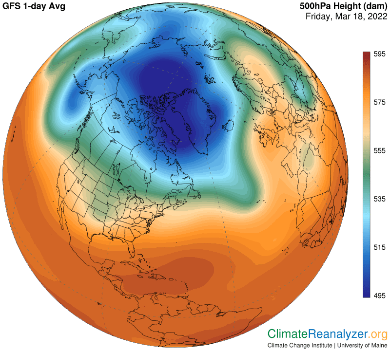
The deep blue zone on the high-altitude air pressure is relatively large and compact at this time. It could temporarily squeeze off some of the large amount of PW coming in at the one wide entry point, but as summer approaches the current size and shape of the blue zone will be prone toward withering away.
Carl