I want to record and save the current image of high altitude air pressure configuration from this ideal vantage point, partly for archive purposes and partly for the sake of demonstrating the effects of its highly distorted shape on jetstream pathway formation. The unusual setup that results can then be demonstrated to have an extraordinary and basically unpredictable influence on courses realized by atmospheric rivers (ARs) as they approach, leading to more than the usual number of distorted weather events. Some of these events are turning out to be notably extreme in one direction, others in the opposite direction.
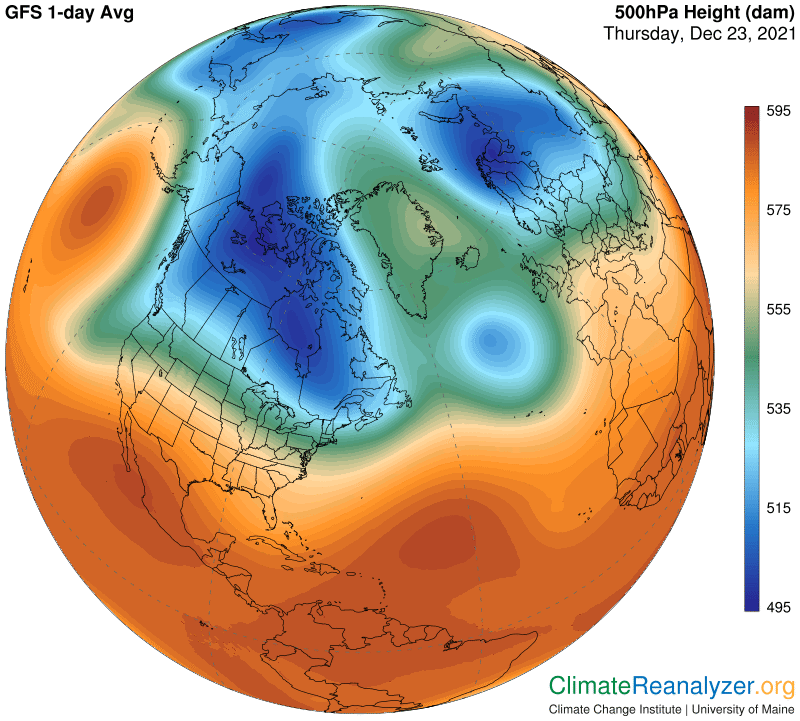
The configuration of different shadings you are looking at represents actual gradients of higher and lower air pressure differentials at three to four miles of altitude, which are quite different from pressure differentials at the surface. The altered configuration favors the creation of a whole new wind system, dominated by jet streams. Certain gradients favor the establishment of regular pathways that accommodate streams featuring exceptionally high wind speeds. The fastest winds of all are generally found on long stretches of fairly straight pathways, and also in places where any two pathways are in close proximity, side by side, and thereby mutually reinforcing.
There are four major pathways containing streams of jet-winds that are all independent from each other. These paths are delineated by differences in shade coloration. The innermost pathway tracks the light blue border of the blue zone. Next, a pathway that tracks the dark fringe on the border of the green zone. There are two pathways in the interior parts of the red zone. The first of these tracks along the brightest of the red shadings, identified by a shade in the above image that is seen positioned along the California-Mexican border before dipping more to the south .The outermost pathway is marked by a darker shade of red, the same one that covers most of Central America in the image. The pathway gets very broad in places, leading to winds that may sometimes split up or meander in ways that are the most difficult of any to follow. The isobar lines are always helpful.
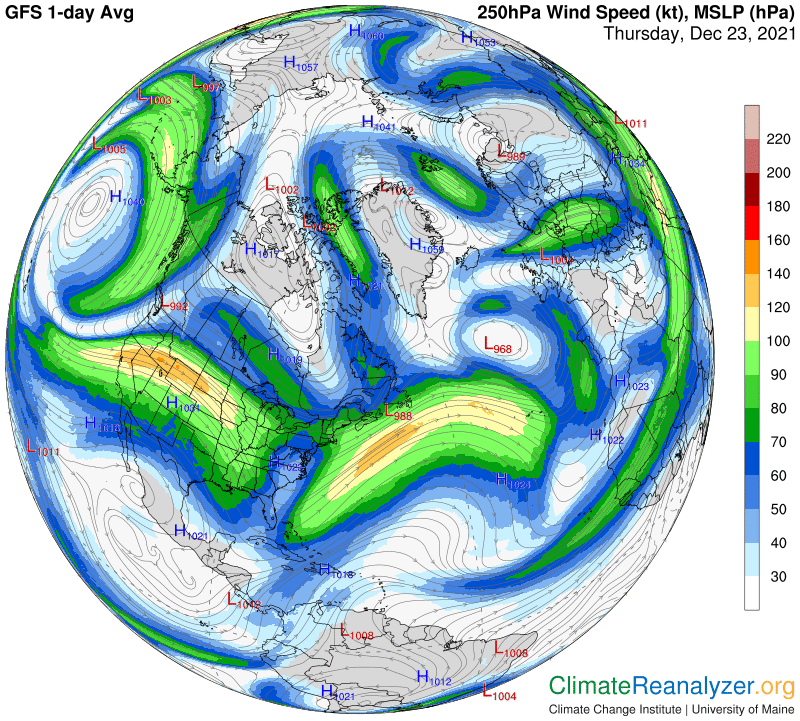
The jetstream pattern now in place in the Northern Hemisphere has plenty of strong streams, but they are not at all organized because of the many distortions in the air pressure layout. The next image shows what happens to visiting ARs and their precipitable water content as a result, when streams of each type come into contact—inevitably and unavoidably.
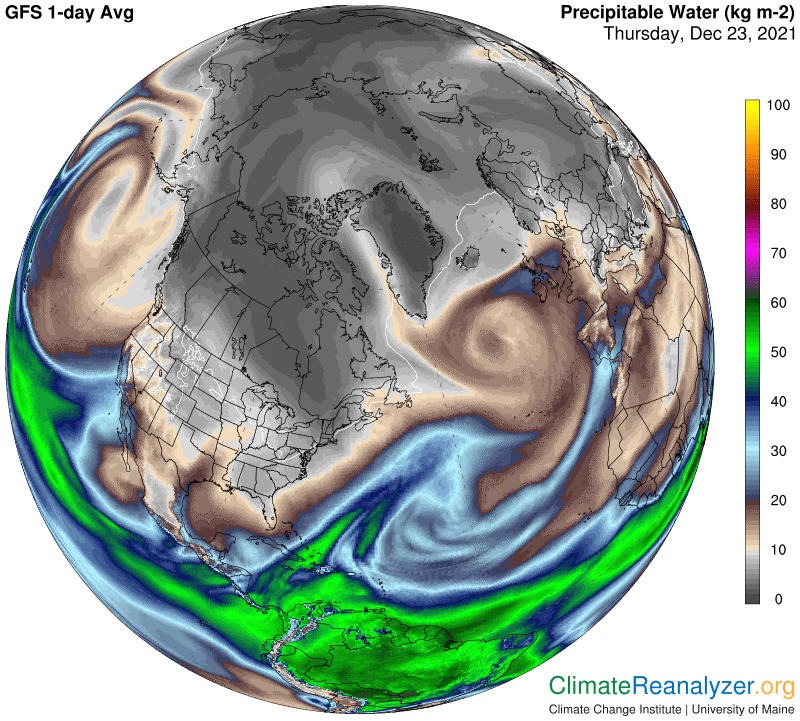
In order to get the best view of these relationships you need go directly to the weather map website, https://climatereanalyzer.org/wx/DailySummary/#t2, at any convenient time, and use the clicker to toggle back and forth repeatedly, with an eye out for corresponding details.
Carl