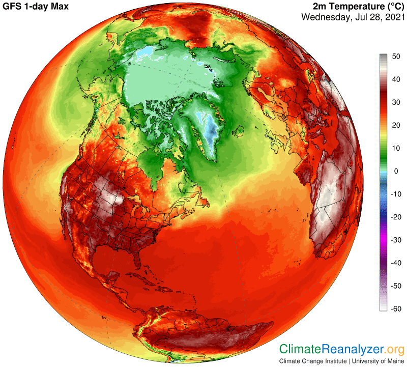
The hottest spot in North America is still well to the north. For the past 24 hours (mostly Tuesday) the honor went to South Dakota and central Minnesota, where highs were around 113F (45C)—making for a rare sight on this map:
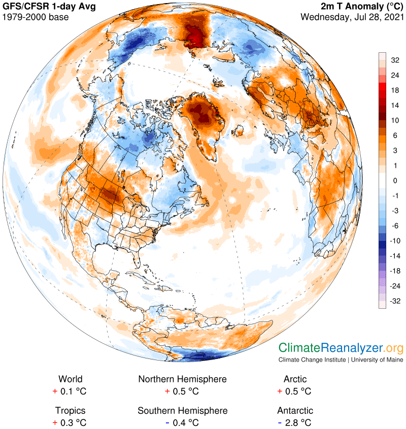
The average temperature in this area was much less, on the order of 85F, which holds the anomaly down to a little less than 10C (or about 16F) for the full 24 hours. That by itself is not an extreme number, but at this time of year it still hurts, and by comparison everywhere else on the continent people felt much more comfortable:
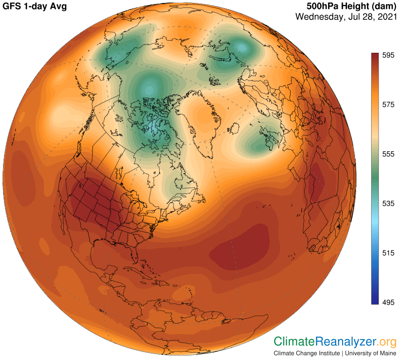
What would be the cause for this anomaly? Carl’s theory tells us that for an anomaly of this size to exist precipitable water (PW) must be a major factor, so let’s open that map first:
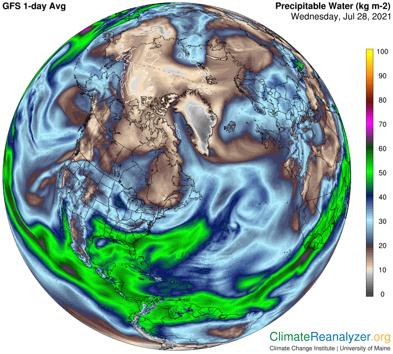
This area comes in with numbers around 30kg, which is about the same or else quite a bit less than almost all of the others in the 48 group. For creating high temperature anomalies, remember, it is not the absolute value of PW that counts but its percentage of departure from normal for that day. This is normally a rather dry part of the country, giving it a relatively low base to work from. We can’t be sure of the exact number, but I would guess something just over 15kg for late July, making enough room for a near double in temperature in this case. We still need to know how such an unusually high concentration of PW made its way into this territory. That sounds like something a high-level jetstream wind might have a hand in doing, so we’ll go to the proper map for a look:
I see one that could be capable of carrying a good load of vapor up and around, starting from along the Pacific coast of Mexico. I can also see how its vapor transport developed from day to day by checking out the map with 5-day animation, and it plainly tells a full story, with the vapor entry being kind of sporadic rather than composed into a steady stream for all of those days. If you can look quickly enough, at http://tropic.ssec.wisc.edu/real-time/mtpw2/product.php, you can still watch it happen.
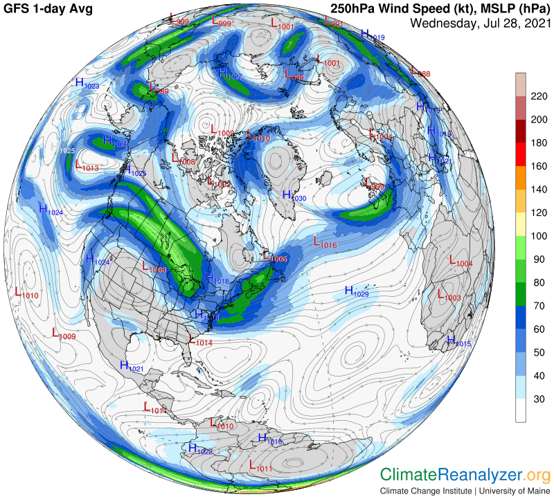
The jetstream wind we are looking at here is of interest because the pathway it tracks is the one found most deeply within the red zone of the upper-level air pressure map. Its isobars fall between one of the darker shades and a lighter shade. On this next map you can see the path at first making a very steep and narrow dip to the south before turning up again and crossing the continent. You can also place another regular jetstream pathway, quite visible on the previous map, between two of the lightest shades within the red zone. (It also looks like there may be a third pathway in the red zone, crowded between these two, which does not often stand out so clearly.)
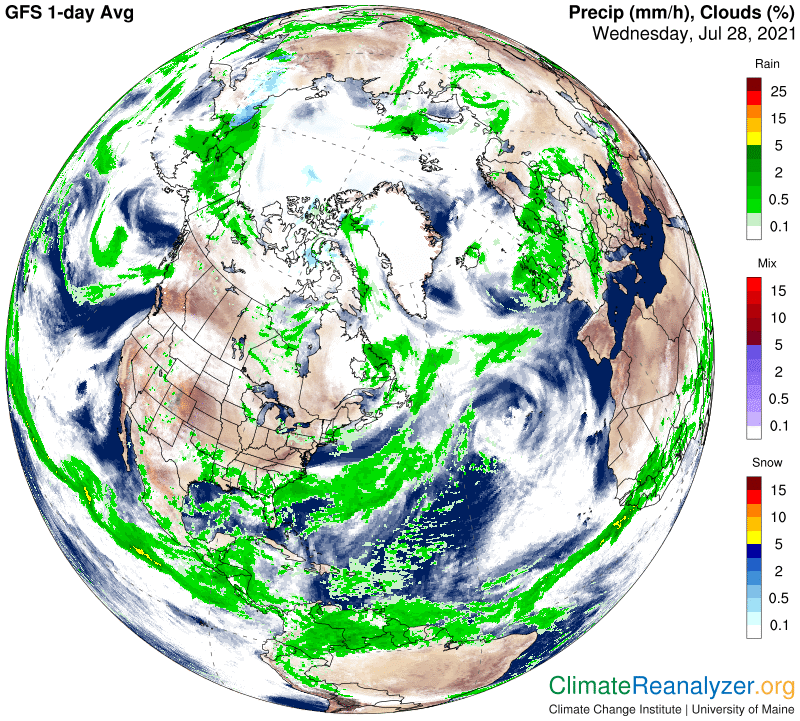
Finally, for the sake of a full record, I want to show the cloud and rain map associated with these particular jets. All I can see is a few light clouds over a long and broad extension, and almost no rain that would act as a coolant. I think the cooling rain seen in east Texas, and some others in states to the east, blew in from the Gulf at a low level, not carried by jet winds of any kind.
Carl