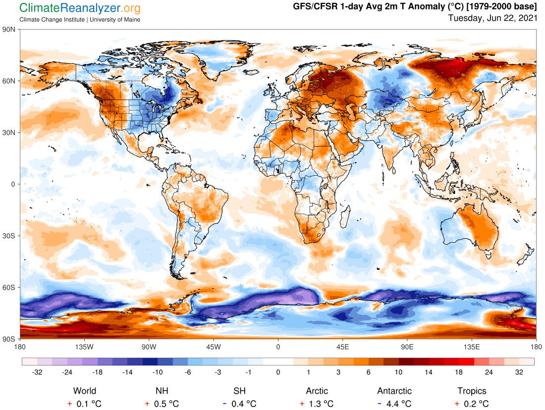
The planet is currently engaged in a cool-down phase, and yet there are two very large regional warm anomalies in effect, both in the Eastern Hemisphere, as we see on this map. The one to the west has temperatures mostly ranging from +5 -10C while in Siberia the range is more like +5-15C, with one spot a few degrees higher. The surrounding far-north coastal area got off to an early surge of warming a year ago and went on to set many records.
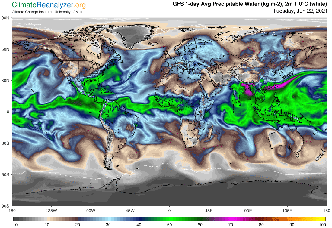
We can attribute both of these regional anomalies to an above normal influx of precipitable water (PW), most of which originated from evaporation in the Caribbean sector of the Atlantic Ocean. You can see how it has progressed on this next map. Present-day readers can get an even better view of how these vapors formed into a massive stream and then traveled in a northeasterly direction by going to the 5-day animated website at http://tropic.ssec.wisc.edu/real-time/mtpw2/product.php.
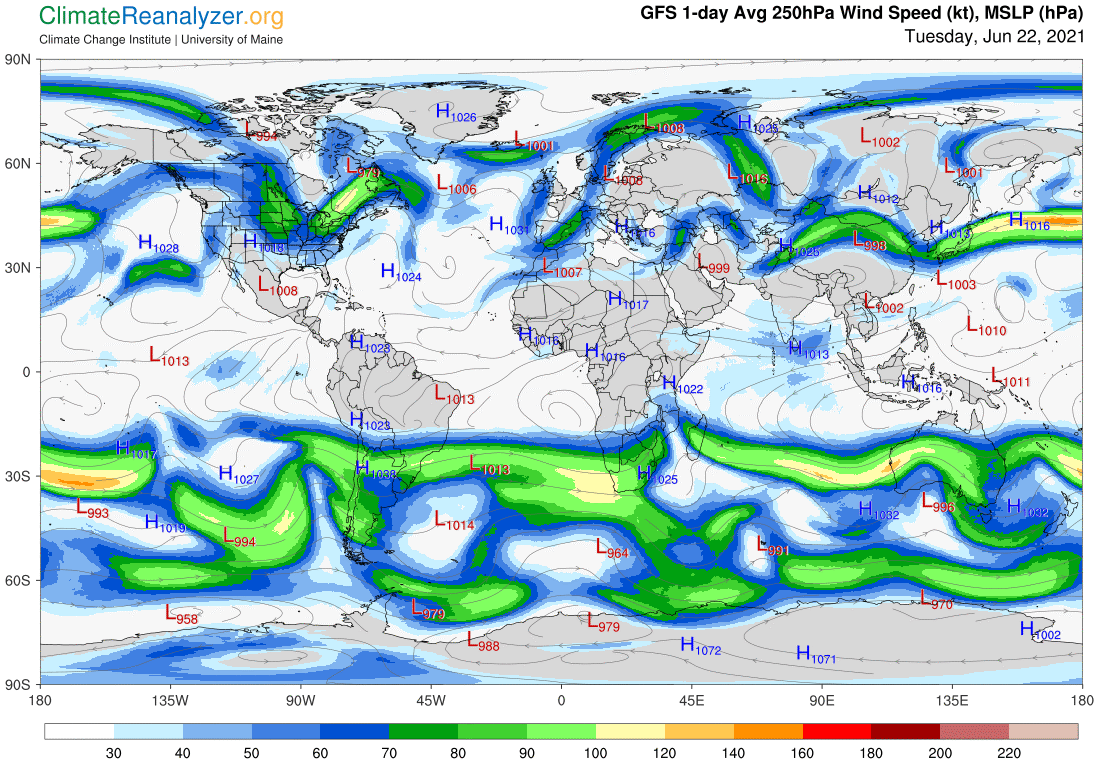
The early part of the vapor trip across the Atlantic was greatly aided by the minimal presence of jetstream winds over that entire area, as you can see on the next map. The winds that were first encountered in the sky just to the west of Europe were generally weak but still strong enough to do some scrambling of the vapor stream flow. Upon leaving Europe more large space opened up, allowing more unchecked migration of the PW. Once again its movement is temporarily impeded by a jet wind, one seen appearing in the center of Russia, before the mass reaches still more open space and finally narrows down. A long journey like this could not possibly have been completed in the Southern Hemisphere by any size of PW stream that had to contend with the kind of winds now seen.
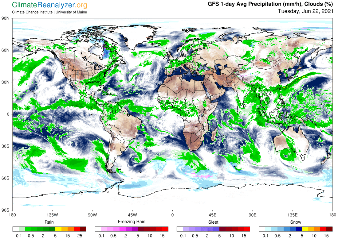
This last image will give you an idea of how this entire PW stream sometimes gives birth to clouds and rainfall as it travels and at other times does not, allowing long stretches of clear sky. As one would expect, these stretches coincide with the most intense warming results at the surface. Also noteworthy is the fact that practically every bit of land within the borders of Europe alone is marked by PW concentrations of the well-above-average type. The few cool spots that we see all tend to be the work of high-albedo cloud tops that appear over some of this PW.
As we get deeper into summer and things get generally warmer we will need to come back and visit this same scenery every so often, looking for anything that may have changed. The prospect is not especially comfortable to think about.
Carl