In these letters I continually stress the importance of knowing the truth about the greenhouse energy effect of streams of high precipitable water (PW) concentrations that enter the upper level of the troposphere on each side away from the tropical belt. Their tremendous heating power, as realized at surfaces far below is partly due to the fact—as observed by instrumentation—that the concentrations are so high to begin with and partly because of their natural tendency to migrate toward the polar zone if there is not too much obstruction in the way. The streams of concentration continually decompose, but remnants often remain hefty enough while migrating to add considerable leverage to the greenhouse energy effect of ambient PW concentrations close to the surface, which keep showing less strength as regions closer to the pole grow cooler.
It so happens that these high-altitude streams are precisely the same ones that are responsible for carrying the source of all the much-needed precipitation that falls on the continental land masses that underlie the pathways of PW migration. Precipitation can only occur after some portion of the PW has condensed into clouds, when may then go on to further condense into larger and heavier particles. The cloud phase is of special interest because of the enormous volumes often produced and because as soon as a cloud comes into existence its top surface can begin to reflect incoming solar radiation, thereby acting as a surface coolant that effectively offsets some of the greenhouse heating being generated by the cloud’s molecular structure.
The albedo effect of clouds, which is known to be highly variable in strength, is a subject of intense scientific study. CL#1957 on June 14 described news of certain recent findings which lead to an understanding that in some situations the cooling effect can be great enough to more than offset the regular greenhouse effect of all the associated PW. My personal observations tend to back up this view, but observations so far are limited to situations like those of today, where length of day is near a maximum in the Northern Hemisphere and thus there should be enough direct sunlight to perform the required warming of the cloud tops. Such warming has been shown to produce effects which significantly increase the total power of solar reflectiveness, beyond that of the angle of incoming rays, by making the cloud more liquid instead of icy. The greenhouse power itself is not altered, but merely offset by a maximum amount.
In today’s letter I will again open three maps that contain a really neat illustration of how these impacts fit together. On this first map look for the unvarying cool anomaly of about -5C that stretches along the east coast of North America from the Carolinas all the way to Labrador:
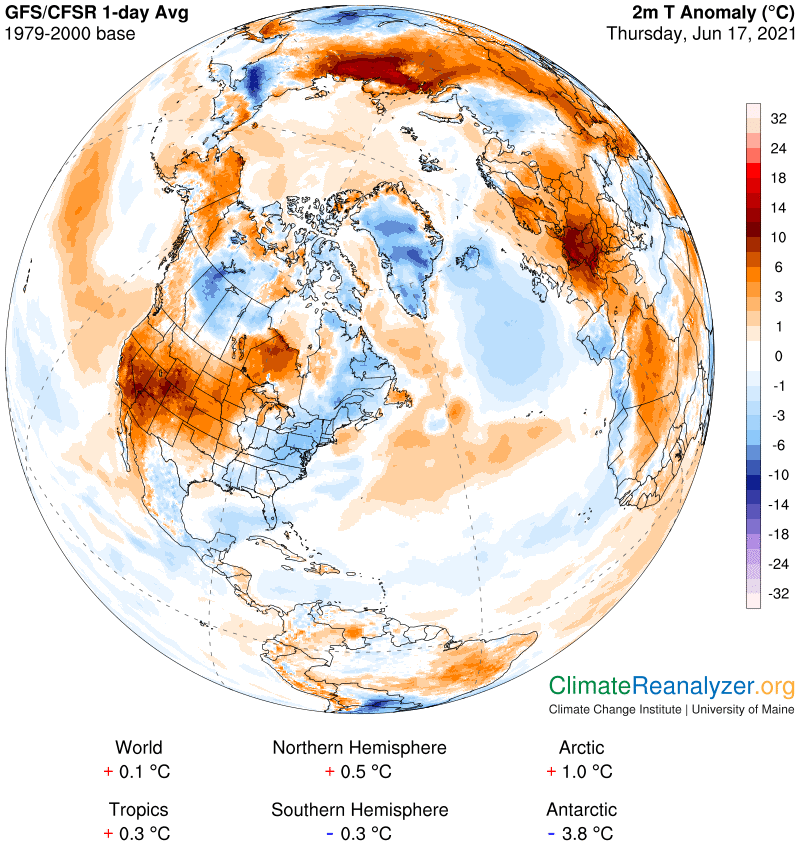
Now the PW map. See how the northern part of the anomaly has a PW value of about 20 kg while the south has only half that much. Shouldn’t the anomaly in the north be at least 10C greater than the southern part?
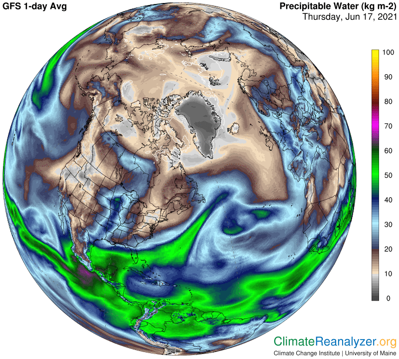
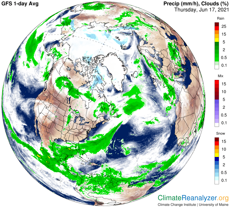
Here is the likely solution, attributed to the contrast created by heavy rain clouds in one and clear skies in the other. These clouds must be producing a full 10C worth of cooling on the ground! Switching gears, the anomaly contrasts that exist between Ontario and northerly parts of the three provinces to the west of it, with both areas high in PW, can likewise be explained by accepting large differences in their overhead cloud albedo strength.
Carl