Some interesting things to point out on today’s weather maps. I’ll start by simply updating the high-altitude air pressure map that is ready to be seen at the top of Friday’s letter. The big bulge in the green zone to the south is now completely gone, allowing water vapor to reenter that space and thus a quick rebound of normal warmth for air temperatures. What I want to draw attention to starts with the long and fairly straight eastern edge of the green zone on today’s map, which is now a little shorter than it was Friday and also in motion. This entire low side of the green zone has drifted a hundred miles or so to the east, bringing it a little closer to the red zone, which will have interesting implications for jetstream strength and positioning.
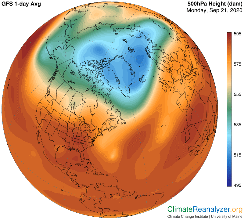
The next map gives us a beautiful picture of how the strongest jetstream legs are now set up around the green zone. The two that are strongest follow the eastern and western edges of the zone—with a notable exception because the long leg on the east does not stop at the lower corner of the green zone. The lower part of this leg actually has formed within the red zone, which has winds blowing for a short distance in the same northward direction before meeting and merging with the green zone jet. The latter becomes the stronger partner of the two as they head together toward Europe. Separately, a jet of reduced strength can be seen in a horizontal position on the southern side of the green zone.
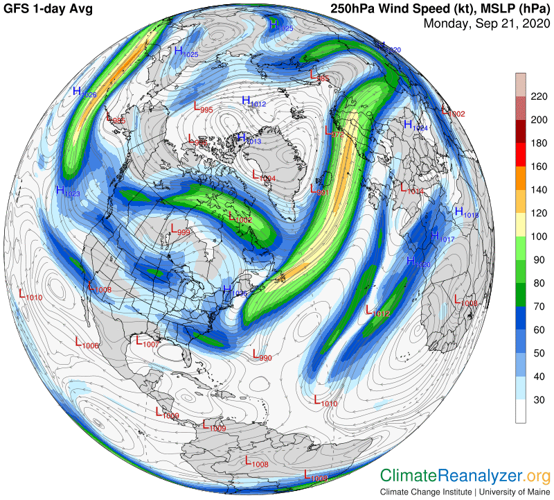
Now back to the red zone, because this is where the fun part begins. See how the red zone shading, which was strong toward the south and has become more tepid as it extends toward Europe, still has shading differences all the way into Russia, whereupon the darker shading turns around abruptly with a hairpin loop and heads back to the west and south, almost all the way to South America, on a parallel pathway. There it makes another hairpin turnaround and heads back toward the northeast on yet one more parallel pathway, toward and beyond Portugal. The two long streaks you see on the jetstream map are positioned exactly where one might expect them to be under this arrangement, following the regular rules of governance that apply no matter how extreme or irrational the entire pattern may be.
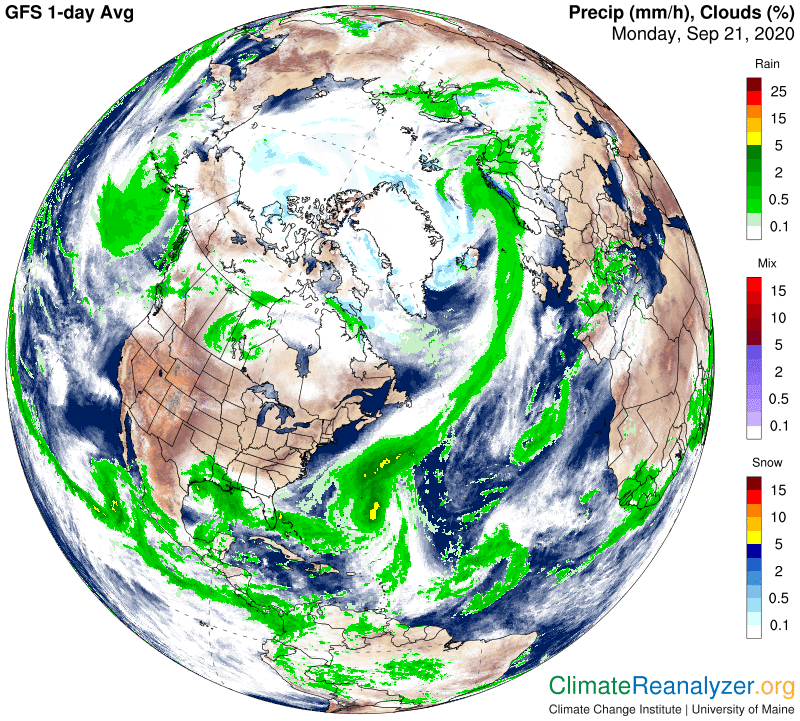
Meanwhile, a massive stream of water vapor that is emerging from the Caribbean Sea region is also heading in the same general direction, but is quickly coming into contact with the foremost long leg of jetstream wind along the edge of the green zone. We’ve already noted how this leg is being steadily maneuvered sideways toward the east because of green zone movement. As we’ll see on the next map, this wind is clearly guiding the path being taken by the vapor stream, but is never able to altogether block its forward progress until the situation finally gets all tangled up in northern Europe.
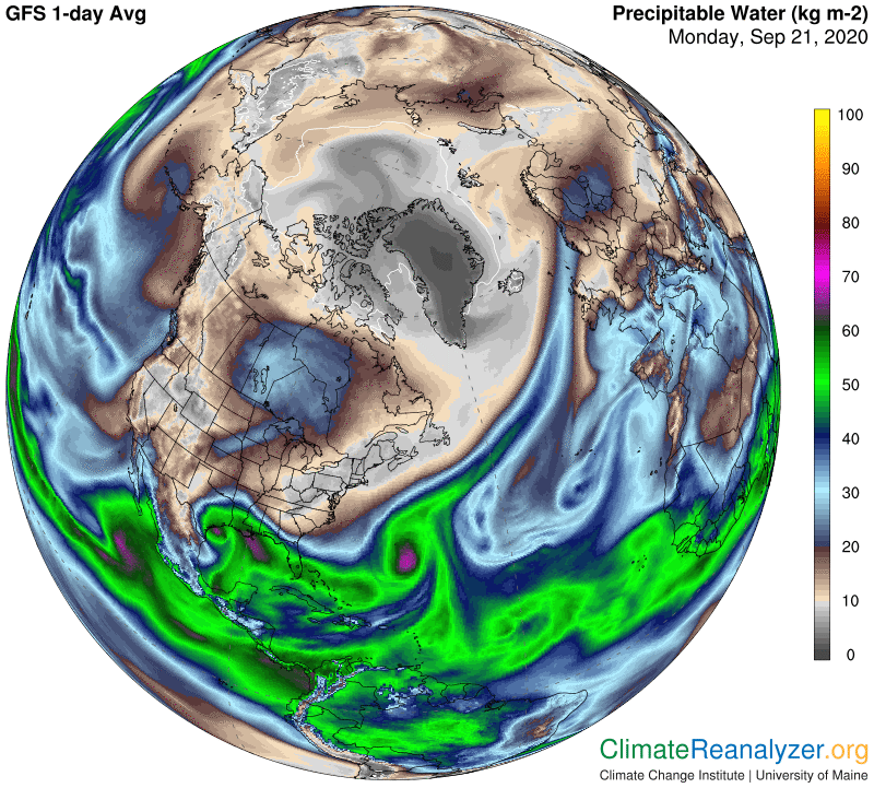
This particular vapor stream managed to spread some loose vapor and its warming power over land when it disintegrated, but otherwise lost most of punch because of the long contact with the jetstream, which has produced a massive amount of clouding and oceanic rainfall and is still doing so. A weaker jetstream, like the ones we were looking at just a month or two ago, would not be able to exert so much control over a vapor stream and thus limit its full potential for adding heat to surface air temperatures via extra greenhouse effects.
Carl