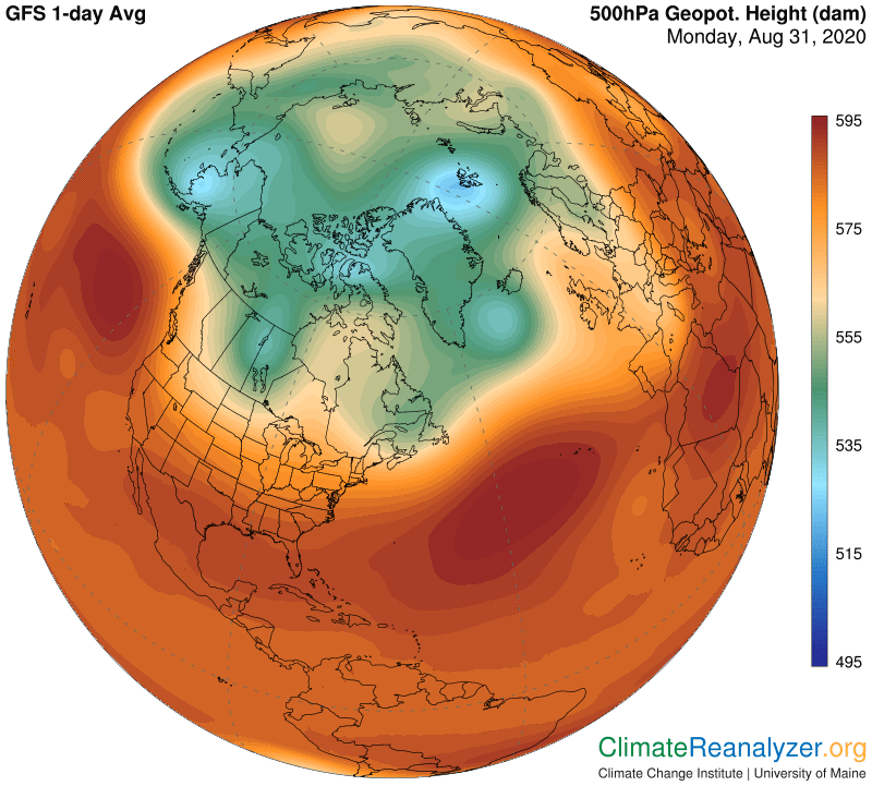
I want to keep a monthly record of how high-altitude air pressure in the polar regions changes over the course of a year, so here is an update of both images. The Arctic has already taken on a much more solid configuration compared to what we were seeing a few weeks ago, all because air temperatures at the surface below are starting to cool and thus the air itself is contracting in volume. The means the constant 500hPa (or millibar) level in the upper atmosphere can sink closer to the surface at whatever places experience the cooling. Since nothing of the sort is happening in the tropics the result is a steepening of the gradients between different altitudes of 500hPa level in the polar area, a phenomenon favoring stronger jetstream winds. At the same time the varying 500hPa levels are being repositioned into a more compact shape, causing certain particular gradient locations that hold the strongest jets to become more organized.
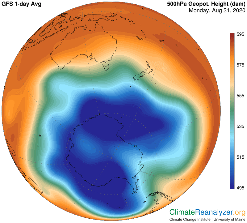
This development serves to restrain the movement of high-altitude water vapor streams over the polar region, along with the warming effect they would otherwise have on air temperatures at the surface. The absence of this warming effectively intensifies the cooling of the air, causing further contraction and thsus an acceleration of the entire process, setting up a positive feedback loop. It happens every year as a normal result of seasonal changeover, amplifying the seasonal difference in temperatures at each pole—with a potential for future changes of intensity. The same chain of cause and effect has now begun in Antarctica, but in the exact opposite direction.
It looks like a piece of the usual pie is missing:
There is an interesting example today of how a strong jetstream wind can influence the behavior of high-altitude water vapor in more ways than one. We’ll start by showing an image of temperature anomalies where you see a clean break from cool to warm over a long, smooth line between Europe and western Asia:
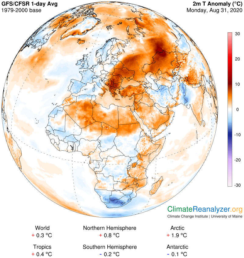
There has to be a reason for why this peculiar shape is in place, and the one thing that quickly comes to mind would be a similarly long and fairly powerful leg of jetstream wind. Notice how the right edge of the jetstream so neatly matches up with the line of demarcation between the anomalies.
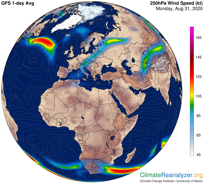
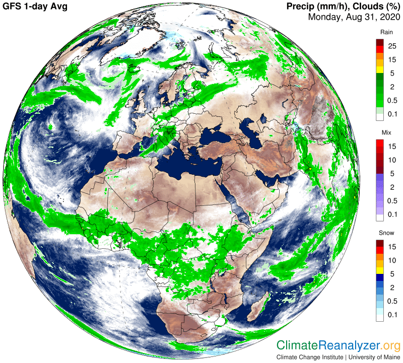
Other maps are showing that the near-entirety of the Mediterranean Sea has gained unusual warmth this summer and is throwing off evaporation in a truly tropical style. This has been causing a broad and steady stream of vapor to be lofted into the heart of the upper-tier wind system that is home to the jetstreams. In this case all of the vapor rising from the western half of the sea is butting squarely into the underside of the pictured jet, where it is compressed and quickly condensed into thick clouds and rainfall that are moving northward and having a standard cooling effect to offset any vapor warming. From the eastern half of the sea the amount of vapor is similar but there is no jet in the way and no sign of condensation. The vapor is thus free to spread its undiluted warming power northward through a clear sky for over hundreds of miles, producing an anomaly (or two) of considerable strength along the way.
Carl