Regional Antarctica has been reporting warm anomalies practically every day for the last several weeks, breaking an opposite trend of long standing. Today is a good example at +2.7C, which should be worthy of a close look. On this map, note that about 80% of the continent alone is covered by a range of +5C and higher while offshore parts within the circle are mostly negative. The oceans outside of the circle are dominated by relative cooling.
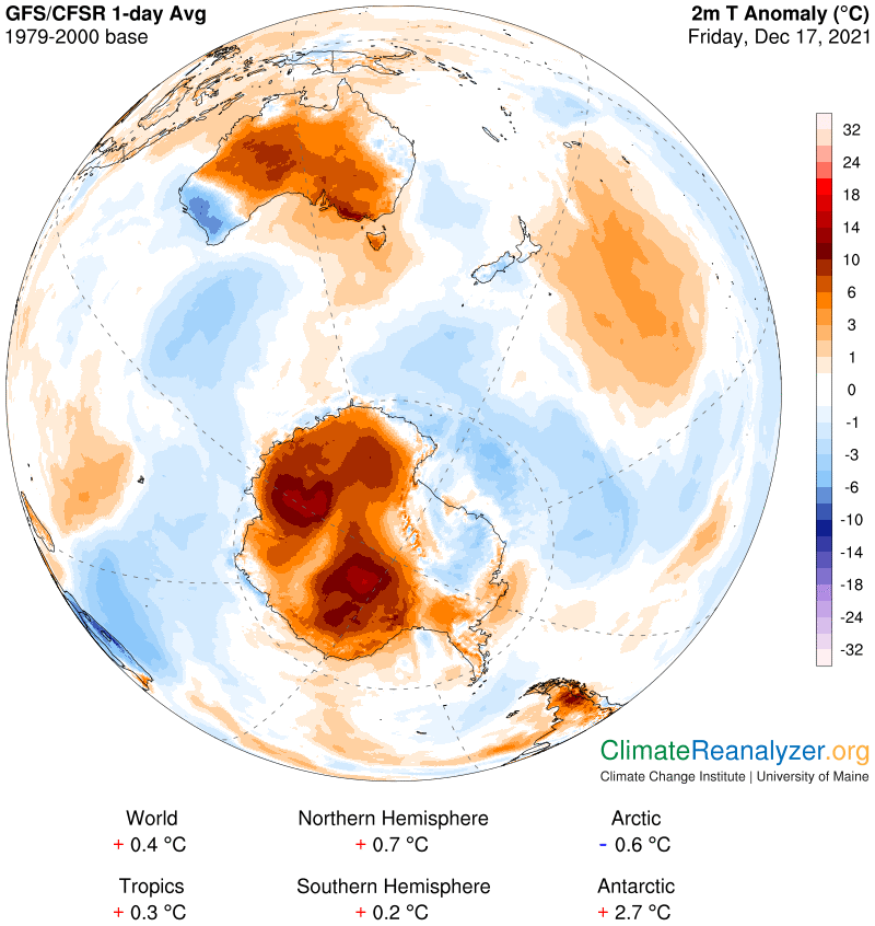
Whatever is causing so much excessive warmth, reaching over 10C in several zones of quite large size, is certainly not being introduced as sensible heat from outside sources. It must be generated locally by one means or another. There is only one thing I can think of that could come even remotely close to doing a job of this size, and that is greenhouse energy production, generated by regular sources that are up in the atmosphere. There are always a number of greenhouse gases on hand, the same ones that are spread out evenly throughout the entire global atmosphere, but none that are emitted locally, as far as Antarctica is concerned, in any kind of quantity. Local water vapor could potentially be an exception, but continental Antarctica, being all covered by thick ice, is not known for its surface evaporation. On this map, everything within the thin white line is currently below the freezing mark, including icy meltwater:
That leaves us with only good option—a source of greenhouse energy introduced from outside sources and transported to the air above the continent by a practical and very natural means of movement. We know there is such a means of movement, in the form of atmospheric rivers (ARs). And we know that all ARs are composed of material that includes high concentrations of one of the regular greenhouse gases, water vapor. The rest of the material in an AR is all composed of byproducts of water vapor in the form of small particles following the condensation of water vapor during its AR movement. Since these particles ultimately fall down to the surface as precipitation the entire combination goes by the name of precipitable water (PW). An AR is all PW. To get an image of what an AR might look like all you have to do is to open a map that shows PW concentrations, like this one:
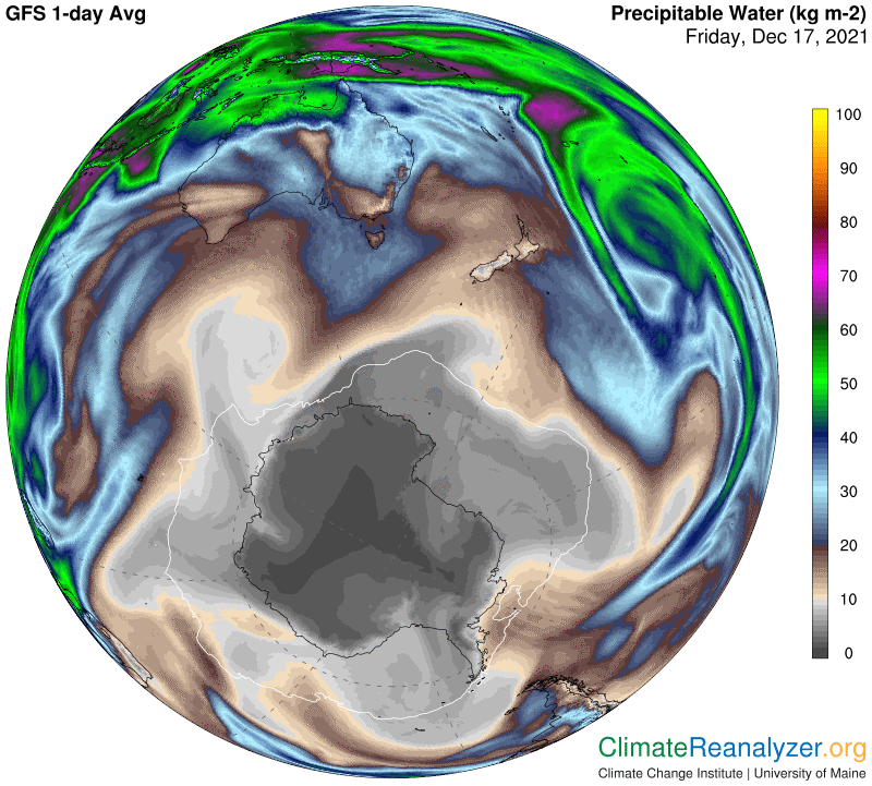
We’ll never know exactly how much of any PW concentration within an AR is water vapor, which should certainly generate a greenhouse energy effect, and how much of the PW consists of particle byproducts, which science has yet to recognize as a “greenhouse” energy producer. Notwithstanding that impediment, any curious individual is perfectly at liberty to match up maps that show the various PW concentrations in ARs as they move with surface temperature anomalies at any location on the same day the AR is passing over that location. In today’s situation we see that the continent is being surrounded by the tail ends of a half-dozen different ARs, each of which, before fading away, holds PW concentrations of 15-20kg per square meter, and more. These high concentrations typically break down and become dispersed upon making close contact with the continental coast, but the remnants that continue making an in-depth approach are still strong enough to raise the normal continental PW content by several multiples. The currently coldest spot in the center of Antarctica, about -30C, shaded in magenta on the above map, is showing a PW value of less than 1kg, and even that rather low figure is above normal—it is actually high enough to generate anomalous warming of +3-4C, as we see on the map! Surrounding areas showing current PW values of 2-3kg are no doubt getting a much greater boost of greenhouse energy.
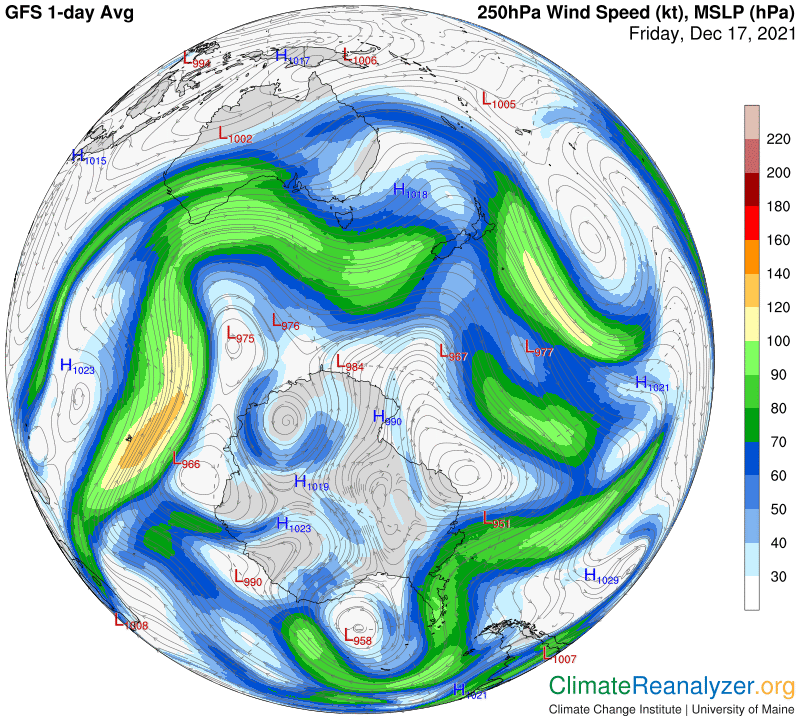
I want to show one more map, with current jet stream activity. Focus on the two loops of moderate wind streams on the left side of the land image. They are each carrying at least 2kg of PW content into the deep interior, in the exact locations where we see the largest anomalies. That’s all it takes to get so much heat when each double of PW value is able to add 10C to the surface temperature.
Carl